
Figures & data
Figure 1. The key elements of medieval drying kilns based on excavated examples. Source: Drawn by author, after R. Rickett and M. McKerracher, Post-Roman and Medieval Drying Kilns (Oxford: Archaeopress, 2021).
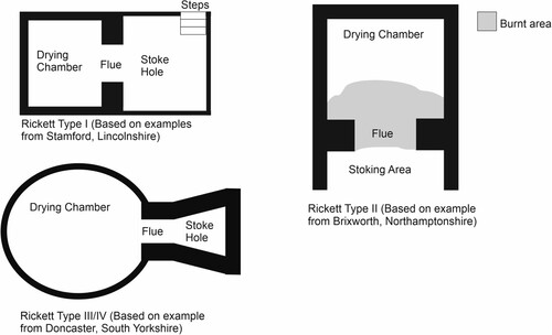
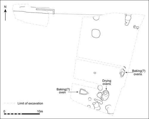
Figure 2. Plan of the excavated plot at High Street, Brackley, thirteenth century. Source: Redrawn by Kirsty Harding after R. Atkins, A. Chapman and M. Holmes, ‘The Excavation of a Medieval Bake/Brewhouse at The Elms, Brackley, Northamptonshire, January 1999’, Northamptonshire Archaeology 28 (1999): 5–24.
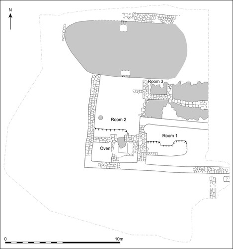
Figure 3. Plan showing the location of drying kilns at The Green, Northampton, late thirteenth to late fifteenth century. Source: Redrawn by Kirsty Harding after M. Shaw, ‘Excavations at The Green, Northampton 1983: The Anglo-Saxon and Medieval Phases’, Northamptonshire Archaeology 41 (2021): 257–304.
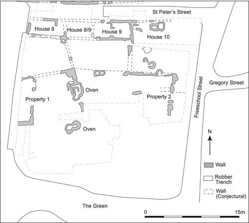
Figure 4. Plan showing the location of drying kilns at Chequer Street, St Albans, between the late fourteenth and the sixteenth centuries. Source: Redrawn by Kirsty Harding after Rosalind Niblett and Isobel Thompson, Alban’s Buried Towns. An Assessment of St Albans’ Archaeology up to AD 1600 (Oxford: Oxbow, 2005), 274–8.
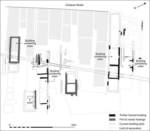
Figure 5. Plan of the north manor at Wharram Percy around the mid thirteenth to mid fourteenth century, showing the location of the postulated grain processing area. Source: Redrawn by Kirsty Harding after Philip Rahtz and Lorna Watts, Wharram. A Study of Settlement on the Yorkshire Wolds, IX. The North Manor Area and North-West Enclosure. York University Archaeological Publications 11 (York: University of York, 2004), 32–3.
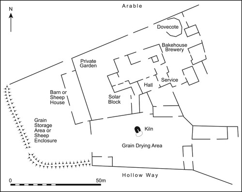
Figure 6. The location of the drying kiln at Peckham Street, Bury St Edmunds (Suffolk), twelfth to thirteenth century. Source: Redrawn by Kirsty Harding after David Gill, ‘40 Peckham Street, Bury St Edmunds' (Unpublished report, Suffolk County Council Archaeological Service, 2012).
Supplemental Material
Download MS Excel (43.1 KB)Data availability statement
The Kilns Online Dataset is available as a supplementary file.