Figures & data
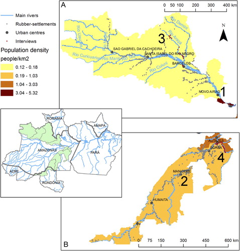
Figure 1. Four research locations and distribution of historical rubber production sites (colocações) in Amazonas State, Brazil. (note: data on rubber production sites from www.sipam.gov.br). A, The black-water River Negro watershed; B, part of the white-water River Madeira watershed. No. 1 indicates the lower Negro research area, No. 2 indicates the middle Madeira research area, No. 3 indicates the Aracá research area and No. 4 indicates the Abacaxi research area. Dots along the Aracá and Abacaxi sub-tributaries mark the approximate locations of families interviewed in the quantitative surveys by LP.