Figures & data
Figure 1. (a) Example area delineated with dashed line assigned to student-pair, Topographic data: SCAN 25 (IGN, Citation2012). Inset: location of the fieldwork site, (b) photo showing typical limestone outcrops, river terraces and alluvial fans in the area
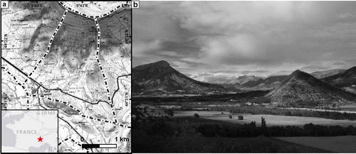
Table 1. Learning goals of various aspects of a fieldwork and ways to improve these by using GIS methods.
Figure 2. Examples of maps made by students in the preparation of their fieldwork (a) elevation map, (b) slope map and (c) false-colour satellite image.
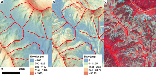
Figure 3. Digital workflow during the fieldwork. (a) Part of an Excel-sheet of students’ observations; (b) example of observation map made by students, showing soil clast size patterns (higher is coarser); (c) students’ digital geomorphological map.
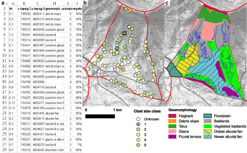
Figure 4. Students’ responses to questions of the pre-fieldwork questionnaire.
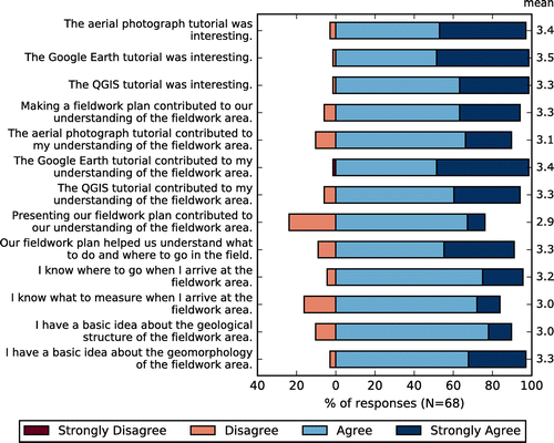
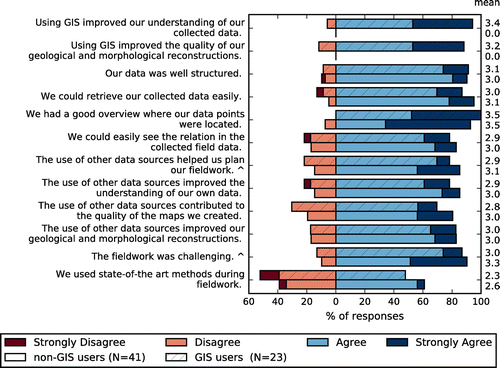
Figure 5. Students’ responses to questions asked after the fieldwork, concerning the preparation, grouped by students that did or did not use GIS during the fieldwork.
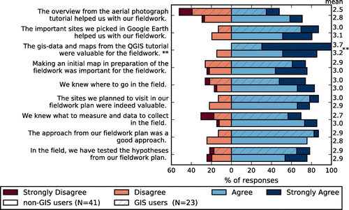
Figure 6. Categorized responses to open-questions on the most useful parts (left) and possible improvements (right) of the preparatory tutorials.
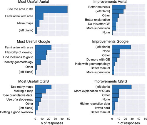
Figure 7. Students’ responses to questions regarding the fieldwork period, grouped by students that did or did not use GIS during the fieldwork.