
Figures & data
Table 1. NI school types and community enrolment, 2019/2020.
Table 2. Average distances between feeder primary and secondary schools (miles).
Table 3. Total distances between feeder primary and secondary schools based on 92.3% of Year 8 transfers 2019–2020 (miles).
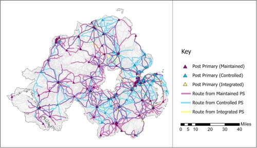
Map 1. Linkages between primary schools and those secondary schools to which pupils transferred in 2019.
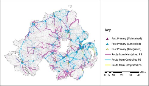
Map 2. Linkages between primary schools and those secondary schools to which pupils transferred in 2019, shown proportional to the numbers involved.
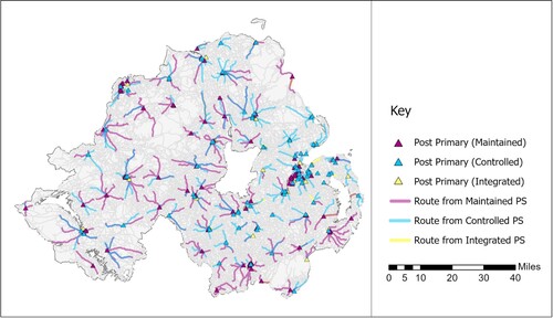
Map 3. Linkages between primary schools and the nearest secondary school.
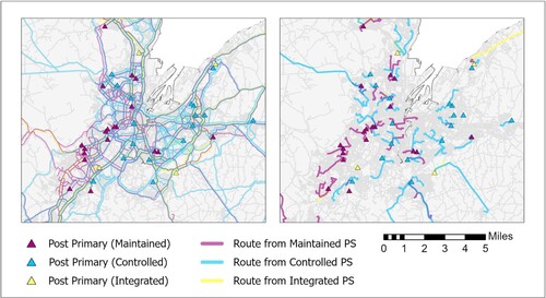
Map 4 and 5. Linkages between primary schools and those secondary schools to which pupils transferred in 2019 (Map 4) and potential journeys to the nearest secondary (Map 5) in the Belfast metropolitan area.
Data availability statement
The data that support the findings of this study are available from the corresponding author, Stephen Roulston, upon reasonable request.