Figures & data
Fig. 1: Map of the eastern Mediterranean with the Levantine and Cypriot sites discussed in this study (map by Ruhama Bonfil)
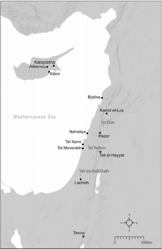
Fig. 2: Sample of Southern Levantine temples mentioned in this study (a–h) and temples from other regions (i–j); note that the spatial complexity of a Mesopotamian (i) and Hittite (j) temple could facilitate many different on-site activities, including production
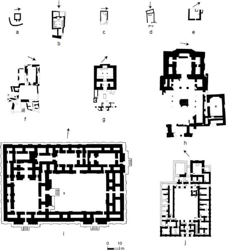
Table 1: Levantine sites mentioned in this study
Fig. 3: The Northern Temple of Hazor with the find spots of two moulds: one for casting jewelry and the other for a figurine (adapted from Yadin et al. Citation1961: Pl. CLVIII:30–31; Bonfil Citation1997: Plan II.7)
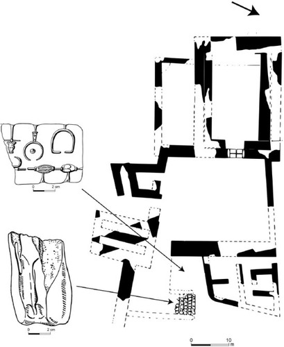
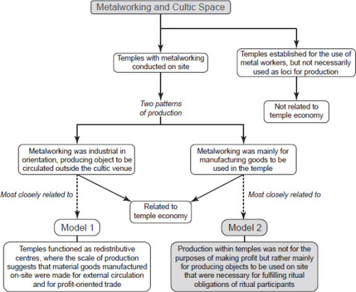
Fig. 4: Relationships between metalworking and cultic space: two models of sacred economies