Figures & data
Figure 1 Map of Cameroon showing location of Mount Cameroon, and sites sampled for bats from November 2016 to July 2018.
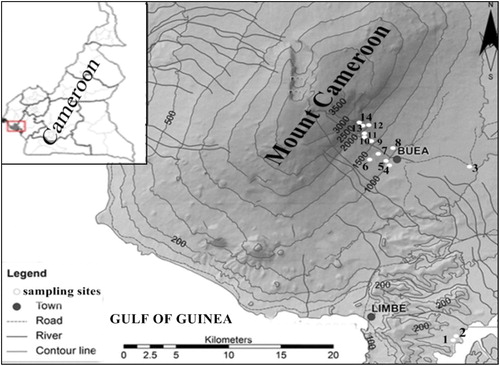
Table 1 Sites sampled, characteristics of habitats sampled, number of individuals captured (N) and species richness (n) in the four vegetation types of Mount Cameroon, sampled from November 2016 to July 2018.
Table 2 Individual per species captured at each vegetation type/elevational range of Mount Cameroon, sampled from November 2016 to July 2018.
Figure 2 Species accumulation curve based on the number of bats captured at all 14 sites sampled on Mount Cameroon from November 2016 to July 2018.
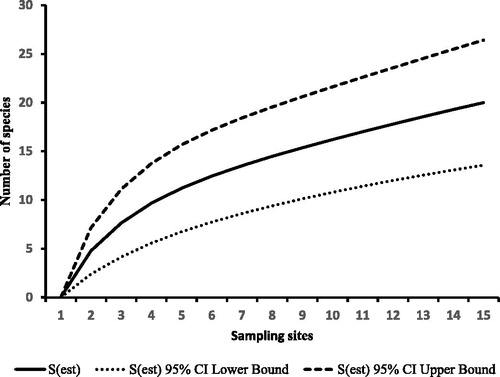
Table 3 IUCN Red List Status, trophic guild, number of bats captured during the dry and rainy seasons and relative abundance of bats on Mount Cameroon, sampled from November 2016 to July 2018. Abbreviations: IUCN Red list status = LC, least concern; NT, near threatened; DD, data deficient. Trophic guild = F, frugivore; N, nectarivore; HCS, aerial insectivore in highly cluttered space; BCS, aerial insectivore in background cluttered space; US, aerial insectivore in uncluttered space.
Table 4 Ranges and means of morphometric measurements for adult bats (males and females) captured on Mount Cameroon, sampled from November 2016 to July 2018.
Figure 3 Bat abundances in four forest vegetation types of Mount Cameroon, sampled from November 2016 to July 2018. Abbreviations: ILF, inhabited lowland forest; CSMF, cultivated submontane forest; MF, montane forest; MS, montane scrub.
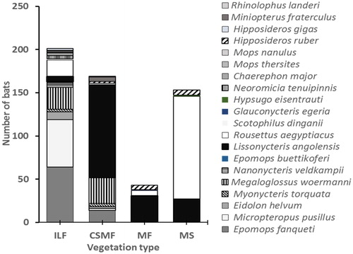
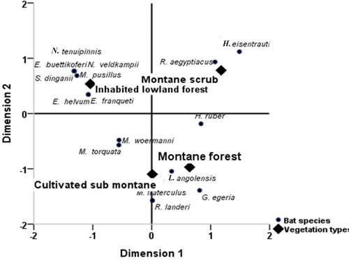
Figure 4 Correspondence analysis scattered biplot based on presence-absence data showing the association between bat species and vegetation types on Mount Cameroon.