Figures & data
Figure 1. Areal extent of the Waterloo Moraine within the Grand River watershed, Ontario, Canada.
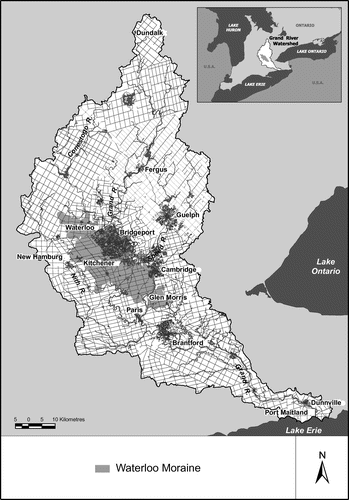
Figure 2. Recharge areas in the central Grand River region. Watershed-scale recharge was derived from the water budget for the Grand River watershed (AquaResource Inc. 2009).
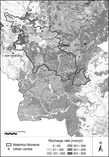
Figure 3. Stream reaches with major groundwater discharge in the central Grand River region. Linkages between discharge points along a reach of the Grand and corresponding contributing areas within the moraine are indicated by particle tracks.
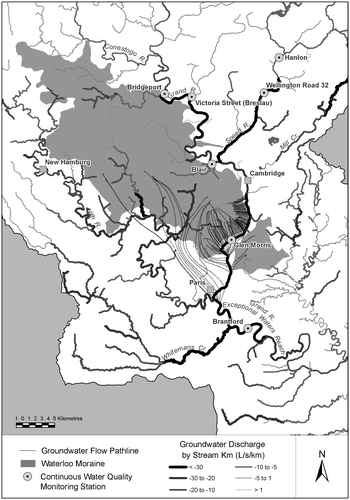
Figure 4. Thirty-day running average maximum daily temperatures in the Grand River at Bridgeport, Glen Morris and Brantford.
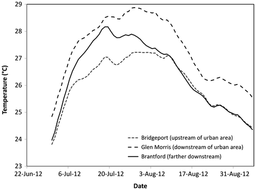
Figure 5. Streams on the Waterloo Moraine with confirmed presence of brook trout (Salvelinus fontinalis). Their presence is strongly associated with the moraine complexes in the watershed.
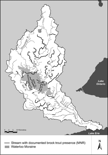
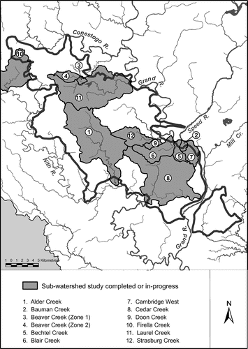
Figure 6. Subwatershed plans on the Waterloo Moraine.