Figures & data
Figure 1. Location of wells sampled in the Waterloo Moraine. The map also displays the historically interpreted Moraine boundary (from Terraqua Investigations Ltd. Citation1995; represented by dash-double dot line) in relation to Silurian and Devonian bedrock formation boundaries (from Terraqua Investigations Ltd. Citation1995; represented by dotted lines), located at the junction of three glacial lobes (based on Chapman and Putnam Citation1984) at the end of the Wisconsinan. A more recent boundary of the Waterloo Moraine is presented by Bajc et al. (Citation2014, this issue).
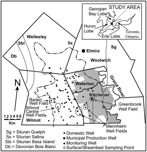
Figure 2. Conceptual diagram of the multiple aquifer/aquitard system within the Waterloo Moraine (adapted from Bester et al. Citation2006, with permission).
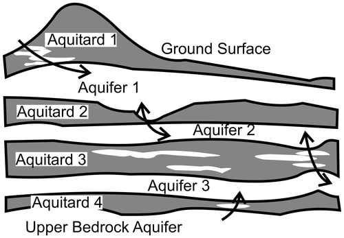
Figure 3. Concentrations of CFC-11 vs. CFC-12 measured from groundwater samples collected within the Waterloo Moraine. Solid line represents CFC-11 and CFC-12 concentrations in water based on measured atmospheric concentration and a recharge temperature of 6°C. Most CFC-12 concentrations were much higher than expected (from Johnston et al. Citation1998, with permission).
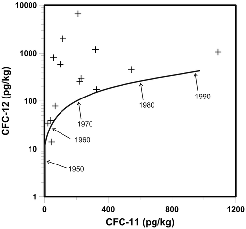
Figure 4. Helium-4 (4He) concentrations from wells screened in the upper aquifers. A significant number of samples have higher 4He concentrations than expected, indicating presence of older waters (from Stotler et al. Citation2011, with permission).
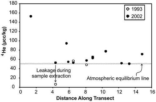
Figure 5. Piper diagram displaying trends in major ion geochemistry within Waterloo Moraine aquifers. (a) Fluids from the perched and water table aquifers; (b) fluids from the lower and bedrock aquifers. In (b), results from wells located in the Greenbrook well field are circled in grey dashed and solid lines (adapted from Stotler et al. Citation2011, with permission).
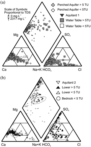
Figure 6. Chloride (Cl) loading with time in (a) Greenbrook well field and (b) Mannheim well field. Data are from Stotler et al. (Citation2011, with permission) and Region of Waterloo (Citation2012).
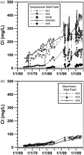
Figure 7. Road salt loading functions for different road types in the Region of Waterloo (from Bester et al. Citation2006, with permission).
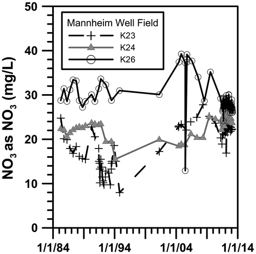
Figure 8. Nitrate (NO3) loading with time in the Mannheim well field. Data are from the Region of Waterloo (Citation2012).