Figures & data
Figure 1. Region of Waterloo study area.
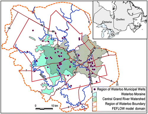
Figure 2. Finite element model mesh refinement (numerical model Layer 1).
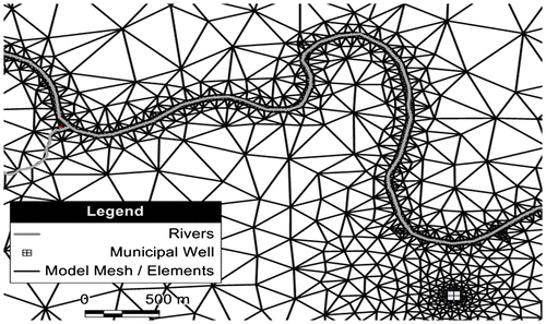
Figure 3. Conceptual hydrostratigraphic and groundwater flow model layers (adapted from Bajc and Shirota Citation2007; reproduced and adapted with permission, Queen’s Printer for Ontario).
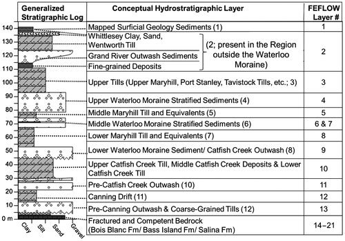
Figure 4. Spatial and time-varying aquifer-stream hydraulic gradient and baseflow discharge along Laurel Creek.
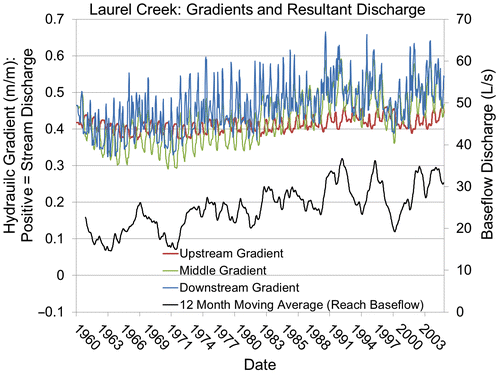
Figure 5. Initial (pre-calibrated) hydraulic conductivity zones in model Layer 6. Well fields also shown.
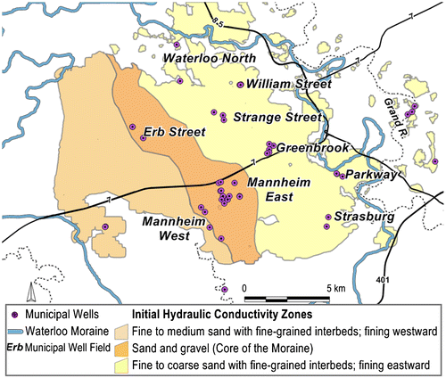
Figure 6. Calibrated hydraulic conductivity zones in model Layer 6.
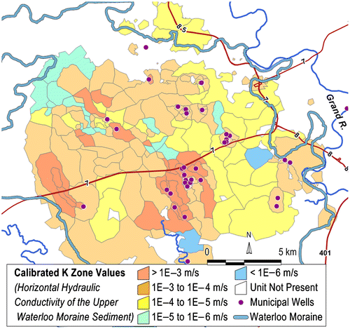
Table 1. Regional model calibration summary statistics.
Figure 7. Scatterplot illustrating the steady-state head calibration.
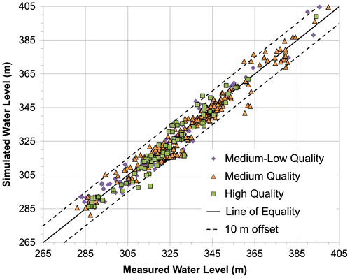
Figure 8. Erb Street well field transient calibration example.
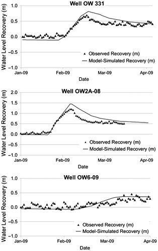
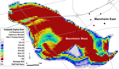
Figure 9. Composite capture zone for the Mannheim West well field.