Figures & data
Figure 1. Waterloo Region with its three cities and four rural townships, also showing the Waterloo Moraine (shaded grey).
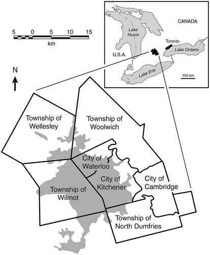
Figure 2. Well fields in the Region of Waterloo. Well fields discussed in this paper are labelled.
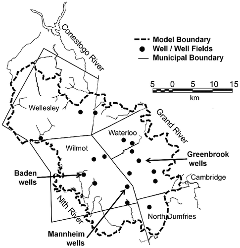
Figure 3. Urban growth in the area of the Greenbrook well field from (a) 1950 to (b) 2000. Figure b also shows the capture zone for the well field obtained from the 280-year capture probability plume (from Bester et al. Citation2006, with permission).
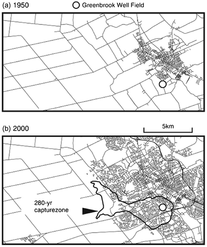
Table 1. Threats to drinking water in urban and rural areas (adapted from Ontario Ministry of the Environment Citation2006).
Figure 4. Well vulnerability maps for the Greenbrook well field: (a) maximum relative concentration (C/C0) expected at the well field due to a potential source (reference point X) within the capture zone, (b) time taken to reach maximum concentration at the well field, (c) time taken to breach threshold value of 10−4 relative to source concentration, (d) exposure time to concentrations above threshold value. Map values at X are values expected at well for source at X (from Frind et al. Citation2006, with permission).
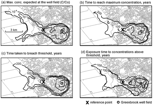
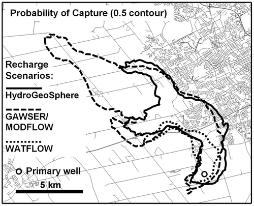
Figure 5. Simulated well capture zones for a municipal well within the Mannheim well field, Region of Waterloo. Capture zones correspond to three different boundary scenarios in terms of the spatial distribution of recharge, generated by the models HydroGeoSphere, GAWSER/MODFLOW and WATFLOW, respectively (adapted from Sousa et al. Citation2013a).