Figures & data
Figure 1. This orthophoto shows a sample measurement of wetlands, riparian, natural and ecologically sensitive areas. Their size is indicated by the superimposed white units.
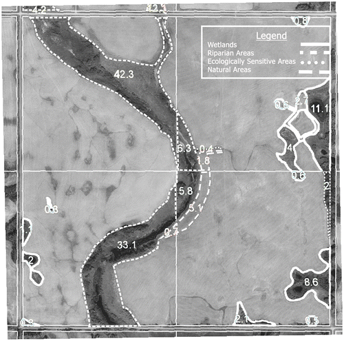
Table 1. The agri-environmental footprint index (AFI) indicator matrix, specific to the Alternative Land Use Services program (ALUS), captures three agri-environmental dimensions: natural resources, biodiversity and landscape.
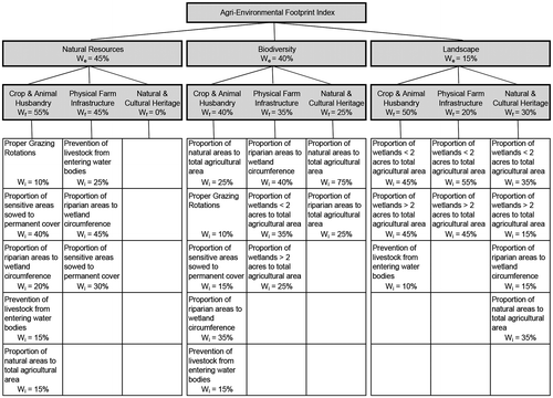
Figure 2. The detailed agri-environmental footprint index (AFI) assessment criteria matrix specific to the Alternative Land Use Services program (ALUS) indicates the weights assigned to agri-environmental AFI dimension (We), ecological management foci (Wf) and indicators (Wi).