Figures & data
Figure 1. (a) Hydrography of the Richelieu River watershed and (b) daily mean, maximum and minimum annual flows at Fryers Dam on the Richelieu River.
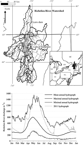
Figure 2. Frequency analysis – experimental non-exceedence probability against the best-fit distribution for (a) lake levels (normal distribution), (b) April–May total precipitation (Gumbel distribution), (c) April mean temperature (normal distribution) and (d) mean annual maximum simulated snowpack (Gumbel distribution). All values are watershed-averaged, with the exception of lake levels.
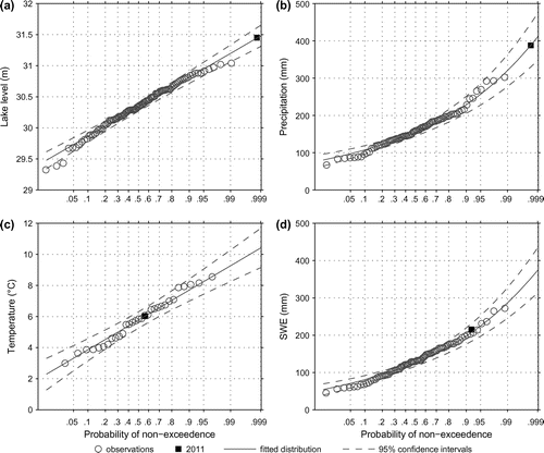
Figure 3. Comparison of observed and simulated lake levels at Burlington station 04294500.
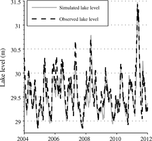
Table 1. Lake levels associated with the 1993, 1998, 2008 and 2011 floods, with their corresponding returning periods.
Figure 4. Mean snowpack accumulation over the Lake Champlain watershed. SWE: snow-water-equivalent.
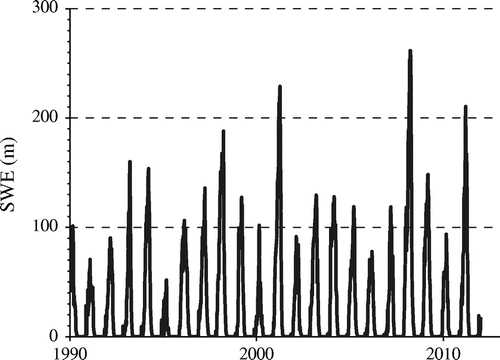
Table 2. Annual maximum snowpack averaged on the watershed associated with the 1993, 1998, 2008 and 2011 floods, with their corresponding return periods.
Table 3. Monthly mean temperatures from February to June for 1993, 1998, 2008 and 2011 floods, with their corresponding return periods.
Table 4. Monthly and seasonal liquid precipitation over the watershed for the 1993, 1998, 2008 and 2011 floods, with the corresponding return periods.
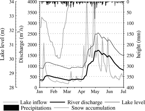
Figure 5. Graphical analysis of (a) 1993, (b) 1998, (c) 2008 and (d) 2011 spring floods, considering lake levels (O. for observed, S. for simulated), Richelieu River discharges (O. for observed, S. for simulated), lake input, precipitation and snow accumulation over the watershed.
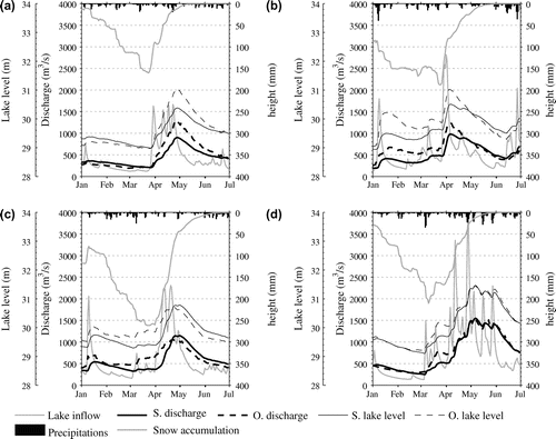
Figure 6. Graphical analysis of the theoretical flood created by mixing 2008 winter meteorological data with 2011 spring data.