Figures & data
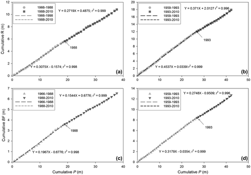
Figure 1. Basins draining the Oak Ridges Moraine (ORM) with streamflow records from the Water Survey of Canada, the ORM management boundary and the extent of outcropping glaciofluvial deposits (OGS Citation2003). Cross-sections presented in Figure are indicated.
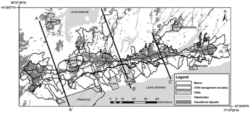
Figure 2. Geologic cross-sections of the Oak Ridges Moraine (ORM) and areas to the north and south. Geology for cross-sections B–B’ and C–C’ described in Earthfx Inc. (Citation2013).
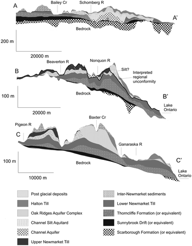
Figure 3. Percentage of basin area consisting of outcropping glaciofluvial deposits vs. (a) basin area and (b) mean basin slope.
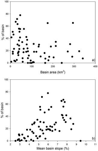
Figure 4. Areas classed as (a) urban, (b) forest and (c) open water plus wetland in basins draining the Oak Ridges Moraine (ORM) based on the Southern Ontario Land Resource Information System (SOLRIS) for the period 2000–2002. The Water Survey of Canada (WSC) station codes for basins discussed in the text are indicated.
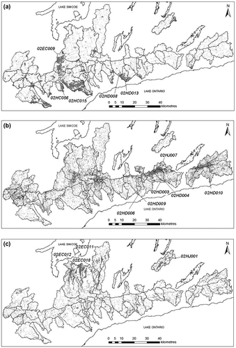
Table 1. Summary of climatic, runoff and baseflow metrics across all years of record and all basins.
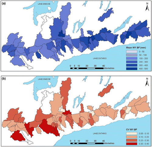
Table 2. Best-fit multiple regression relationships for baseflow metrics. Regression coefficients are significant at p = 0.001 for bolded independent variables, at p = 0.01 for italicized variables and at p = 0.05 for underlined variables. n = number of basins used in multiple regression analysis. BF: baseflow; BF/P: baseflow/precipitation; BFI: baseflow index; CV: coefficient of variation; PC: principal component.
Figure 6. (a) Basins with significant positive correlations between baseflow (BF) and precipitation (P) in a given water year (WY); (b) basins with significant negative correlations between BFI and P in a given WY. Basins left blank did not have significant correlations or were not analyzed for baseflow due to flow regulation.
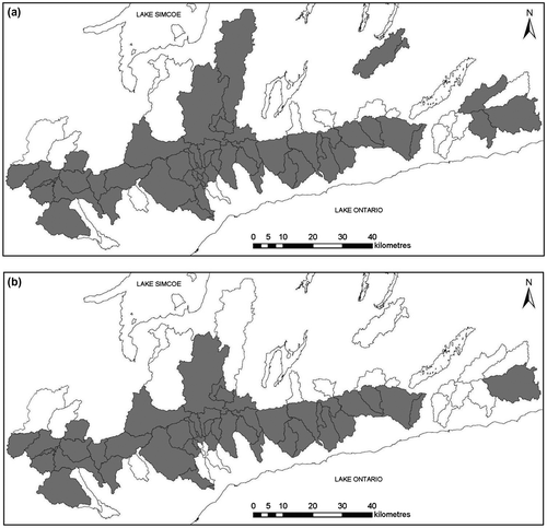
Figure 7. Basins with (a) above- and below-average baseflow (BF), and (b) above- and below-average baseflow index (BFI). Basins left blank had BF or BFI values within 1 standard deviation of mean values across all basins or were not analyzed for baseflow due to flow regulation.
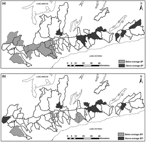
Table 3. Thresholds of basin area, % glaciofluvial deposits (GFD), mean basin slope and percentage of forest and urban coverage associated with basins with mean baseflow (BF), and baseflow index (BFI) more than 1 standard deviation above or below the mean across all basins.
Table 4. Basins with ≥ 10 water years (WYs) of record with statistically significant temporal trends. Values are the slopes of the Kendall–Theil Robust Lines determined for each trend. P: precipitation; BF: baseflow; BF/P: baseflow/precipitation; BFI: baseflow index.
Figure 8. Basins with significant temporal trends in (a) precipitation (P), (b) baseflow (BF), (c) baseflow/precipitation (BF/P) and (d) baseflow index (BFI). Basins left blank in (a) did not have significant trends or did not have sufficient data to conduct trend analyses. Basins left blank in (b–d) did not have significant trends, did not have sufficient data to conduct trend analyses or were not analyzed for baseflow due to flow regulation.
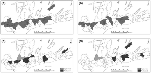
Figure 9. Double mass curves for cumulative runoff (R) vs. precipitation (P) for (a) 02EC009 – Holland R at Holland Landing and (b) 02HD008 – Oshawa Cr at Oshawa, and for cumulative baseflow (BF) vs. P for (c) Holland R at Holland Landing and (d) Oshawa Cr at Oshawa.