Figures & data
Figure 1. The Lake Champlain and Richelieu River watershed.
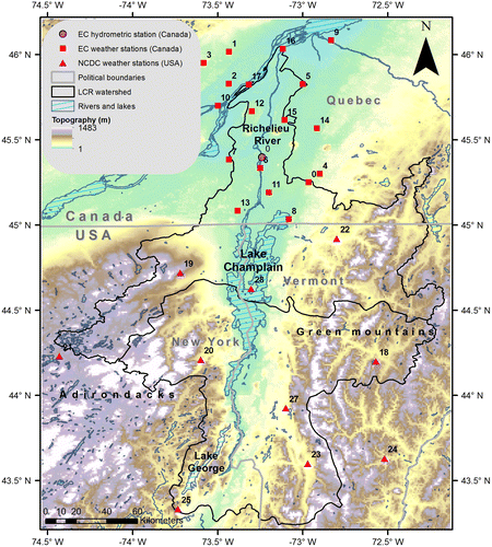
Figure 2. Hydrograph (in m3/s), hyetograph (in 0.1 mm) and daily temperature variability (in 0.1°C) recorded by the South Hero weather station and the Fryers Rapids hydrometric station in 2011.
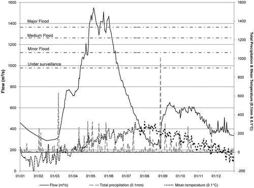
Table 1. Definition and description of hydro-meteorological indicators.
Figure 3. Dot plot of the inter-annual standardized anomalies of hydrometeorological events according to the 1981–2011 reference period; all abbreviations are defined in Table .
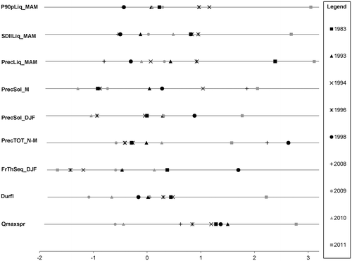
Table 2. Scale, shape and location parameters (respectively given in parentheses) of marginal distributions fitted to hydrometeorological indices and stations.
Table 3. Description of the probable flood attenuating scenarios.
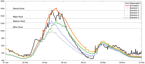
Figure 4. Hydrograph of the 2010–2011 observed and simulated daily flows (in m3/s on the vertical axis) from the 2010–2011 observed meteorological conditions and from flood-attenuating scenarios 1 through 5, with respect to the various flood thresholds determined by the Ministère de la Sécurité Publique du Québec (MSP; dashed horizontal lines).