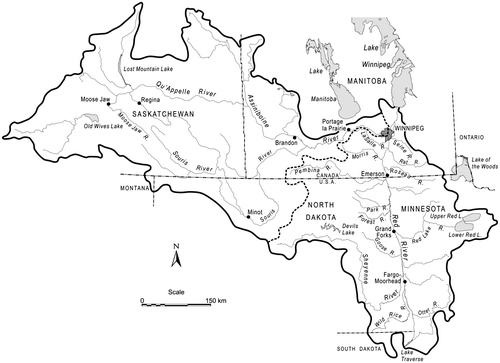
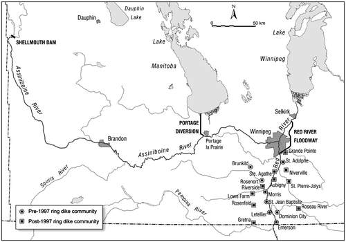
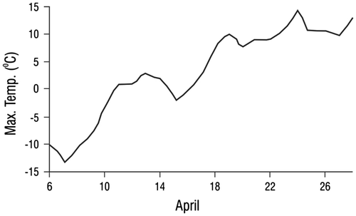
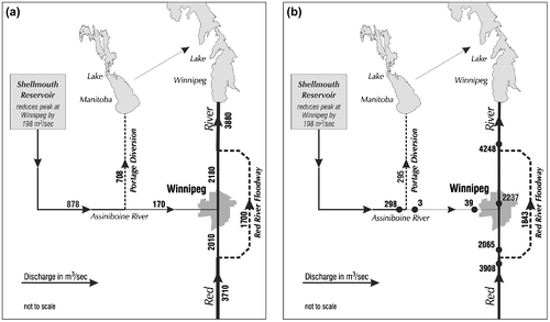
2,877
Views
23
CrossRef citations to date
0
Altmetric
Articles

The 1997 flood event in the Red River basin: Causes, assessment and damages

Pages 45-55 | Received 10 Jun 2014, Accepted 22 Dec 2014, Published online: 02 Apr 2015

Figures & data

Figure 1. Red River drainage basin.

Figure 1. Red River drainage basin.

Figure 2. Major Red River flood control structures.

Figure 2. Major Red River flood control structures.

Figure 3. Daily maximum temperatures, Winnipeg, April 1997 (Rannie Citation1998b).

Figure 3. Daily maximum temperatures, Winnipeg, April 1997 (Rannie Citation1998b).

Table 1. Peak discharges and dates, Fargo, North Dakota, to Winnipeg.

Figure 4. 1997 flooded area (“Red Sea”) in Manitoba, Z dike and 1826 flood limits.

Figure 4. 1997 flooded area (“Red Sea”) in Manitoba, Z dike and 1826 flood limits.

Figure 5. (a) Routing of water during a design flood (after Mudry et al. Citation1981). (b) Routing of water on 4 May 1997.

Figure 5. (a) Routing of water during a design flood (after Mudry et al. Citation1981). (b) Routing of water on 4 May 1997.

Reprints and Corporate Permissions

Please note: Selecting permissions does not provide access to the full text of the article, please see our help page How do I view content?

To request a reprint or corporate permissions for this article, please click on the relevant link below:

Academic Permissions

Please note: Selecting permissions does not provide access to the full text of the article, please see our help page How do I view content?

Obtain permissions instantly via Rightslink by clicking on the button below:

If you are unable to obtain permissions via Rightslink, please complete and submit this Permissions form. For more information, please visit our Permissions help page.