Figures & data
Figure 1. Red River drainage basin.
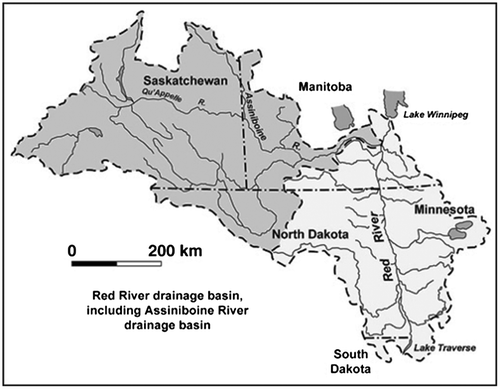
Figure 2. Extent of the 1950 Red River Flood – City of Winnipeg.
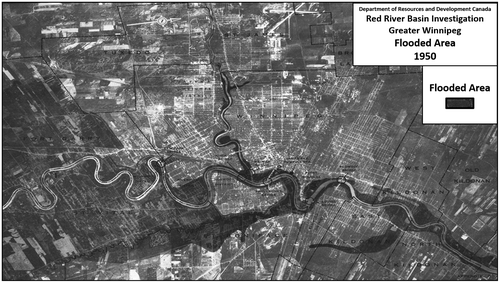
Figure 3. Potential extent of Red River flooding – City of Winnipeg.
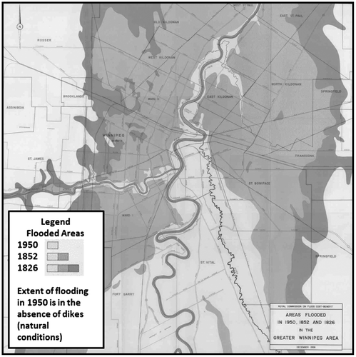
Figure 4. Location of major flood control structures in southern Manitoba.
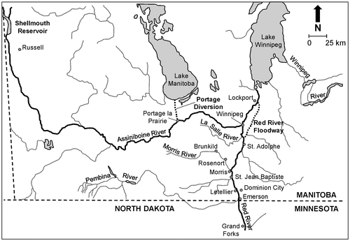
Figure 5. Radarsat image of Red River Floodway.
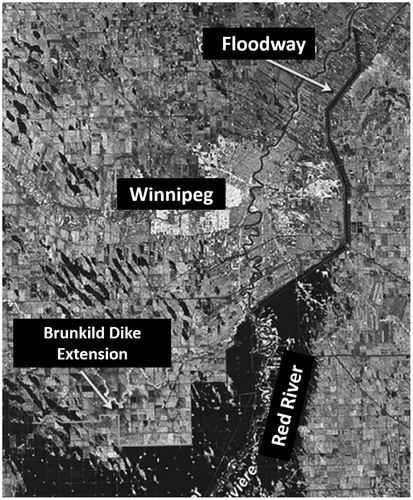
Figure 6. Red River Floodway inlet structures.
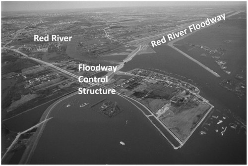
Figure 7. Red River Floodway inlet control structure, showing gates in operating position.
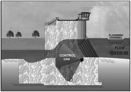
Figure 8. Red River Floodway outlet structures.
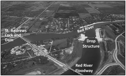
Figure 9. Portage Diversion – from the Assiniboine River to Lake Manitoba.
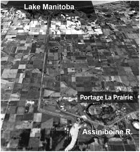
Figure 10. Shellmouth Dam and Lake of the Prairies Reservoir.
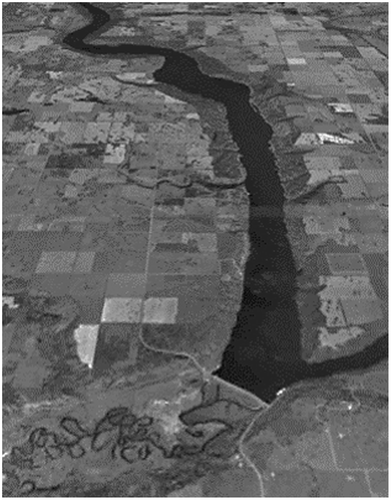
Figure 11. Theoretical routing of flow through the Lower Assiniboine and Red Rivers during the design flood, prior to 1997 improvements (adapted from Mudry, MacKay and Austford Citation1981).
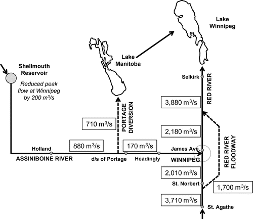
Figure 12. Ring dikes around (a) Morris, Manitoba, and (b) Roseau River First Nation.
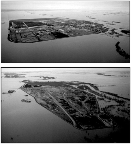
Figure 13. Individual home protection – dikes of pads.
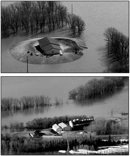
Figure 14. Historical record of Red River peak flows in Winnipeg.
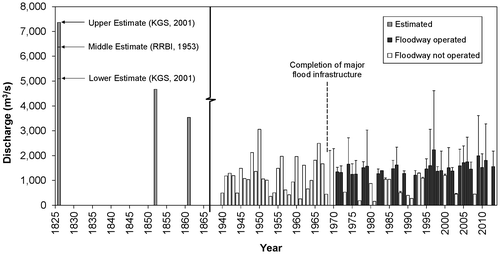
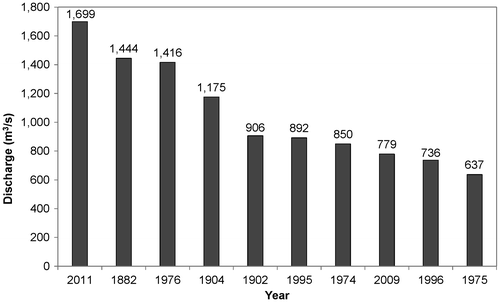
Figure 15. Top 10 peak flow events – Red River at James Avenue in Winnipeg.
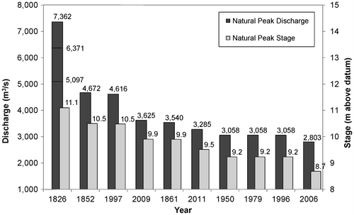
Figure 16. Top 10 peak flow events – Assiniboine River at Portage la Prairie, without flood protection works.