Figures & data
Figure 1. Assiniboine River drainage basin (catchment areas from Agriculture and Agri-Food Canada Citation2013).
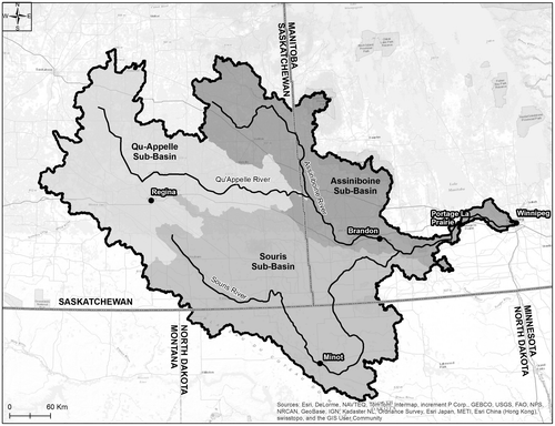
Figure 2. Prairie antecedent precipitation (August to October; 2010 inclusive) as a percent of normal.
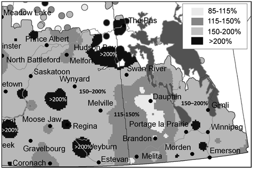
Figure 3. Rainfall amounts for the period between 2 April and 30 June expressed as percentage of normal.
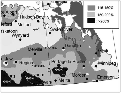
Figure 4. Flows recorded on the Qu’Appelle River near Welby, Saskatchewan.
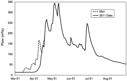
Figure 5. Effects of regulation at Shellmouth on 2011 flows at Brandon (Manitoba 2011 Flood Review Task Force Report Citation2013).
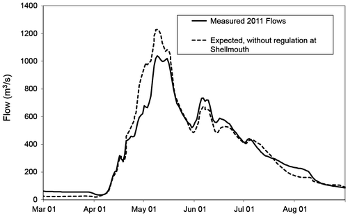
Figure 6. Flows recorded on the Souris River at Wawanesa, Manitoba.
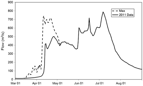
Figure 7. Flows recorded at the Assiniboine River near Holland.
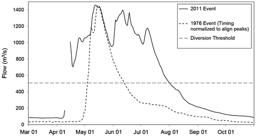
Figure 8. Flow rates through the Portage Diversion.
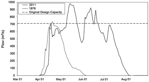
Figure 9. Annual diversion volumes to Lake Manitoba via the Portage Diversion (Manitoba 2011 Flood Review Task Force Report Citation2013).
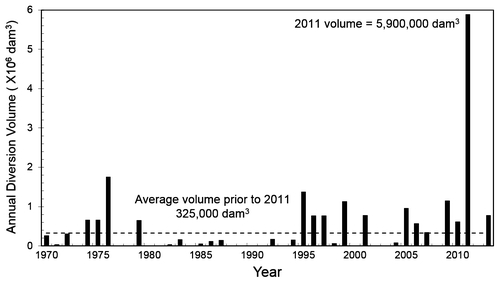
Figure 10. Annual inflows into Lake Manitoba since construction of the Portage Diversion (Manitoba 2011 Flood Review Task Force Report Citation2013).
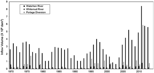
Figure 11. 2011 Water levels on Lake Manitoba (Manitoba 2011 Flood Review Task Force Report Citation2013).
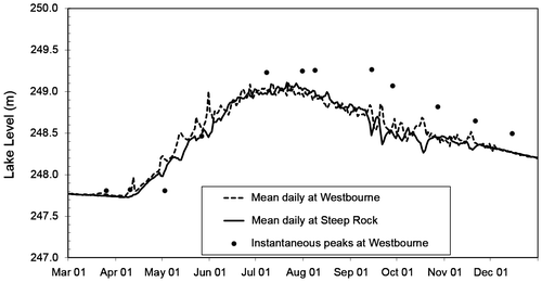
Figure 12. Lake St. Martin recorded levels.
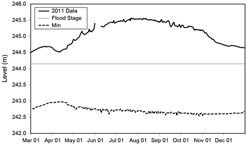
Table 1. Severity of the 2011 flood at locations in Manitoba.
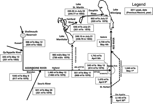
Figure 13. Assiniboine River Basin flows or levels at select locations relative to the previous peak event.