Figures & data
Figure 1. Lake Okanagan, study instrumentation and notable locations of long-term monitoring nearby. Satellite imagery is copyright the Microsoft Corporation. Inset regional location map adapted from Ferguson et al. (Citation1974).
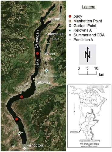
Figure 2. Mean monthly Kelowna A temperatures, 1981–2010 and those observed during the study period. The bars represent one standard deviation from the mean.
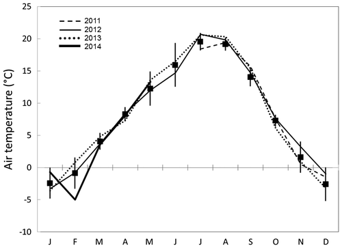
Figure 3. Seven-day running means of air temperature, wind speed, vapour pressure and latent heat flux measured at Manhattan Point (dashed line) and Gartrell Point (solid line) during the study period.
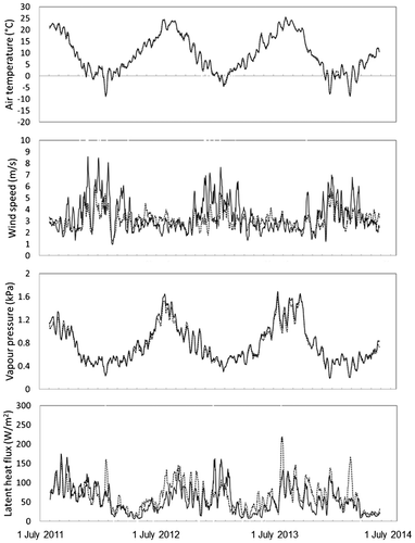
Table 1. Monthly, seasonal, annual observations from Manhattan and Gartrell Points and the north and south arm buoys.
Figure 4. Wind roses for each of the three buoys deployed for period of study. The thick white line illustrates the relative frequency with which wind blows from each 10° of compass direction. Satellite imagery copyright the Microsoft Corporation.
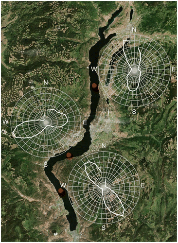
Figure 5. Seven-day running means of Tws, surface–atmosphere vapour pressure differences, and the Richardson number measured at the north (dotted line), center (thick line), south (thin line) buoys during the study period.
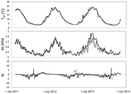
Figure 6. Daily evaporation rates from each beacon vs. the product of wind speed and the vapour pressure gradient from each buoy. Left to right are the relationships between evaporation measurements from Gartrell Point and the product of wind speed and the surface–atmospheric vapour pressure differences at (a) the south, (b) the center and (c) the north buoys. Similarly, the relationships between evaporation at Manhattan Point and the product of wind speed and the surface–atmospheric vapour pressure differences at (d) the south, (e) the center and (f) the north buoys.
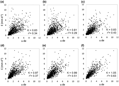
Figure 7. Seasonal cycles are apparent in monthly values of K derived from Gartrell Point evaporation rates and wind and surface–atmosphere vapour pressure differences from the south buoy. The inset shows the dynamic between monthly K and the Richardson number measured at the south buoy from July 2012 to July 2013.
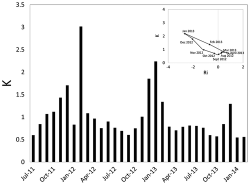
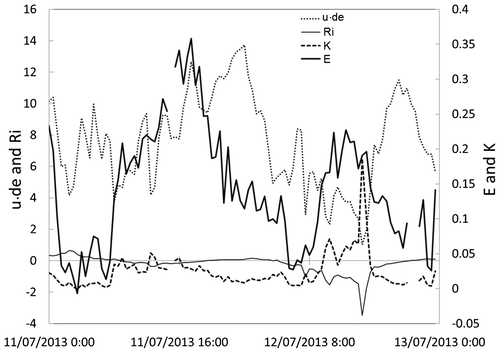
Figure 8. Half-hourly observations of the product of wind speed and surface–atmospheric vapour pressure differences and the Richardson number measured at the south buoy, and evaporation measured at Gartrell Point and the derived K for 11 and 12 July 2013.