Figures & data
Figure 1. Hydrometric and meteorological stations in New Brunswick. The (a) 56 hydrometric stations and (b) four grid boxes corresponding to New Brunswick used in climate change scenarios. Box size ~200 × 300 km; • hydrometric station;
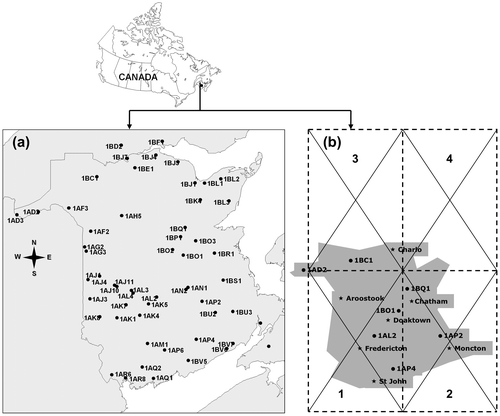
Table 1. Analysed hydrometric stations for the flood frequency analysis (from Aucoin et al. Citation2011).
Table 2. Meteorological stations (from El-Jabi et al. Citation2013).
Table 3. Hydrometric stations (from El-Jabi et al. Citation2013).
Figure 2. Flood frequency analysis for Renous River (NB), station 01BO002.
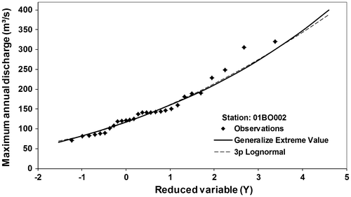
Table 4. Regional regression equations and R2 Generalized Extreme Value (GEV) (from Aucoin et al. Citation2011).
Figure 3. Estimated 100-year flood (daily discharge) as a function of drainage area (km2) for all 56 hydrometric stations (Generalized Extreme Value (GEV) and Lognormal type 3 (LN3)). Regional regression line for both the present study and the EC & NB study (Citation1987) are presented.
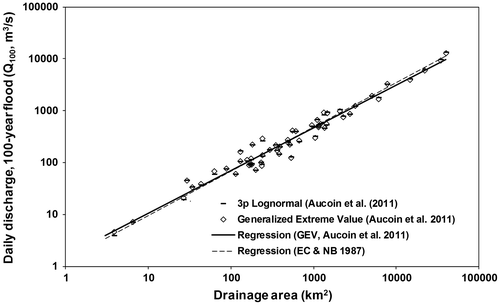
Figure 4. Observed and simulated monthly discharges for SW Miramichi River: (a) mean discharge; (b) maximum discharge.
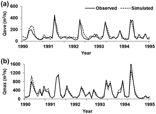
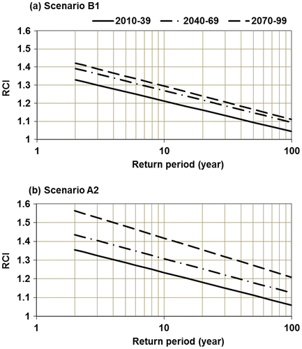
Figure 5. New Brunswick regional climate index (RCI) curves for floods at time slices 2010–2039, 2040–2069, 2070–2099 under (a) scenario B1; (b) scenario A2 (adapted from El-Jabi et al. Citation2013).