Figures & data
Figure 1. The Saskatchewan River basin.
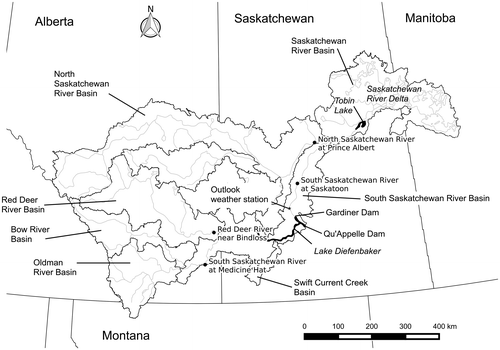
Table 1. Inflows to Lake Diefenbaker in 2005, 2011 and 2013. The live storage ratio is the ratio of the total inflow to the reservoir’s live storage.
Figure 2. Mean monthly discharge of the South Saskatchewan River at Saskatoon, plotted before (1912–1958) and after (1969–2013) the construction of Lake Diefenbaker.
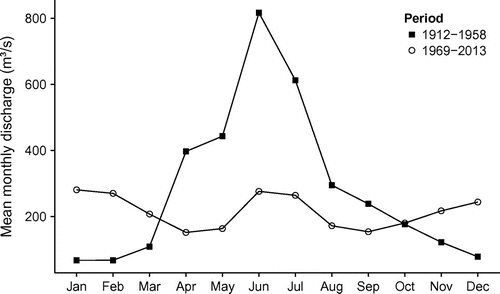
Figure 3. Volume rating curve for Lake Diefenbaker. The points were digitized from the rating curve described in Centre for Hydrology (Citation2012); the lines are splines used for interpolation.
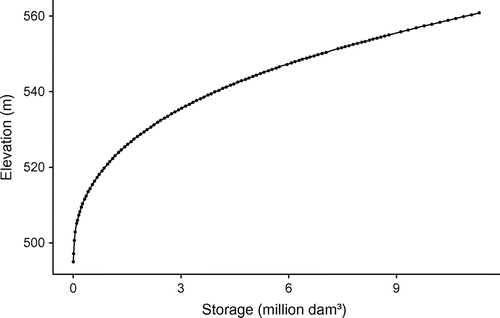
Figure 4. Lake Diefenbaker inflows, outflows and water balance errors in 2005, 2011 and 2013.
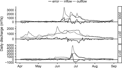
Table 2. Mean daily percentage (as an absolute value) of the water balance error by month for each of the major inflows and outflows.
Figure 5. Adjusted and gauged inflows to Lake Diefenbaker in 2005, 2011 and 2013.
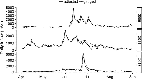
Figure 6. Gauged Alberta inflows to Lake Diefenbaker 1961–2013 for the months of April and May. The lines are least-squares linear regressions. The shaded regions represent the 95% confidence interval of the regressions.
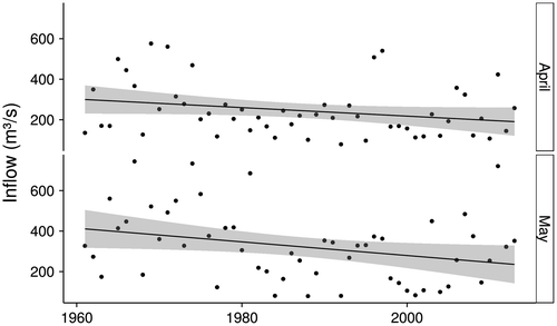
Figure 7. Annual maximum and minimum elevations of Lake Diefenbaker at Gardiner Dam, 1969–2013. The lines are least-squares linear regressions. The shaded regions represent the 95% confidence interval of the regressions.
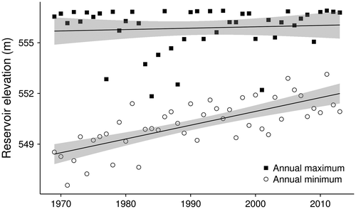
Figure 8. Routed, local and total inflows to Lake Diefenbaker in April 2011.
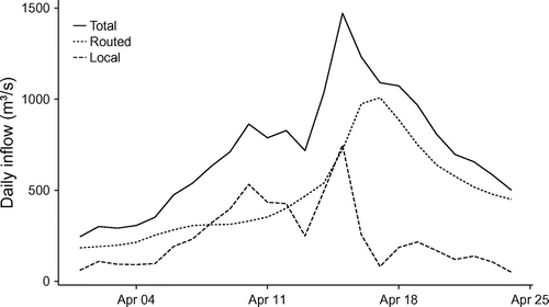
Table 3. Lake Diefenbaker target elevations.
Figure 9. Daily stage of Lake Diefenbaker at Gardiner Dam in 2005, 2011 and 2013. The horizontal lines are the full supply level (FSL). The points correspond to the target elevations listed in Table .
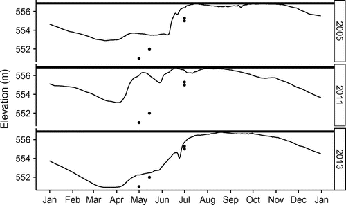
Figure 10. Flooded area–duration curves for agricultural land upstream of Saskatoon in 2005, 2011 and 2013. The curves are calculated based on the inflows to Lake Diefenbaker (by routing, and adjusted) being passed directly through, and on the actual gauged flows of the South Saskatchewan River at Saskatoon.
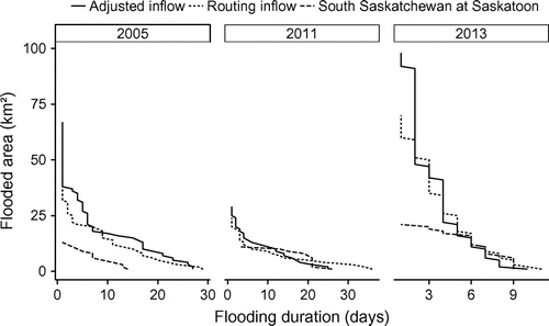
Figure 11. Daily flows of the South Saskatchewan River at Saskatoon and the North Saskatchewan River at Prince Albert in 2005, 2011 and 2013.
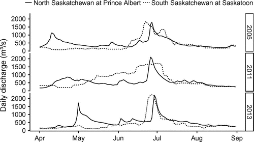
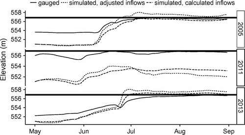
Figure 12. Simulation of Lake Diefenbaker using estimated inflows and outflows, and 1 May target elevations. The horizontal lines are the full supply level (FSL). The gauged lake elevations are also plotted.
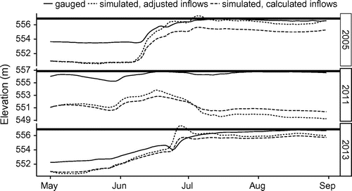
Figure 13. Simulation of Lake Diefenbaker using estimated inflow and 1 May target elevations, with outflows restricted to being below downstream flooding flows. The horizontal lines are the full supply level (FSL). The gauged lake elevations are also plotted.