Figures & data
Figure 1. Location and detail of Vancouver, Canada.
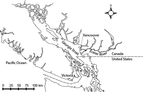
Figure 2. Flood risk as a function of hazard, likelihood and vulnerability.
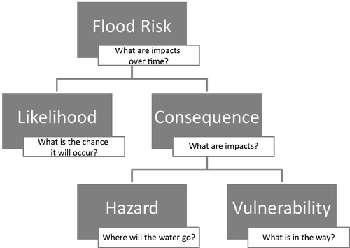
Figure 3. Risk as a function of likelihood and consequence.
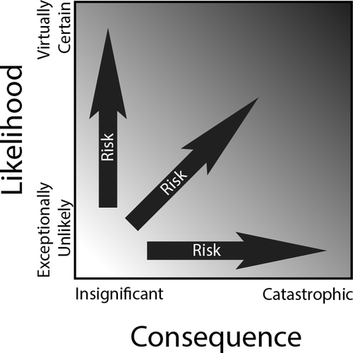
Figure 4. Source–pathway–receptor model for flood risk.
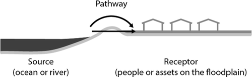
Figure 5. Coastal flood levels for the present and with sea level rise (SLR).
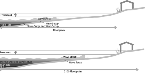
Figure 6. Coastal floodplain of City of Vancouver for the present and with sea level rise.
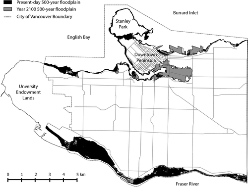
Table 1. Summary of hazard scenarios.
Table 2. Summary of identified vulnerabilities to coastal flooding.
Figure 7. Generic depth–damage curve (after Nastev and Todorov Citation2013).
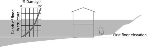
Figure 8. Hazus structure (adapted from Department of Homeland Security, Federal Emergency Management Agency Citation2009b).
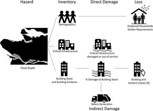
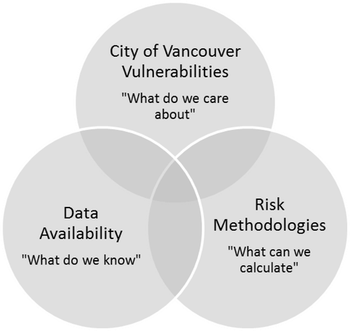
Figure 9. Model to assess gaps in coastal flood risk assessment (CFRA).