Figures & data
Figure 1. Locations of the Souris River Basin, study area boundary (four-degree buffer around Souris River Basin), meteorological stations and potential tree-ring sites. The tree-ring sites ultimately used are labeled with the site names.
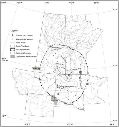
Figure 2. Example multiresolution decomposition of tree-ring chronology at Boundary Bog, Saskatchewan, Canada.
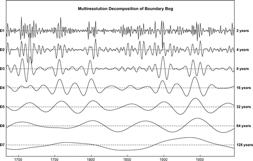
Figure 3. Dendrogram for cluster analysis with horizontal line intersecting five groups branched below the line.
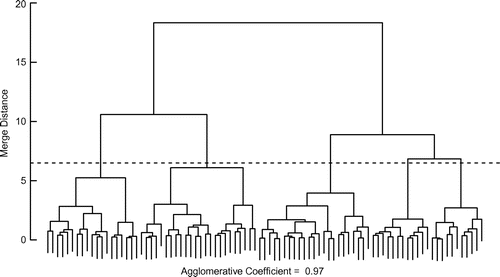
Figure 4. Boxplots of mean seasonal total precipitation for each group.
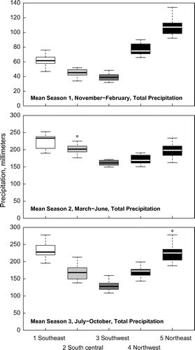
Figure 5. The five clusters in the study area. (The additional meteorological stations had shorter or seasonal periods of record and were not used for the cluster analysis.)
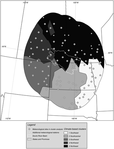
Table 1. Information and associated statistics for precipitation models.
Figure 6. Group 1 (southeast), season 2 (March–June) modeled and observed 12-year moving average precipitation.
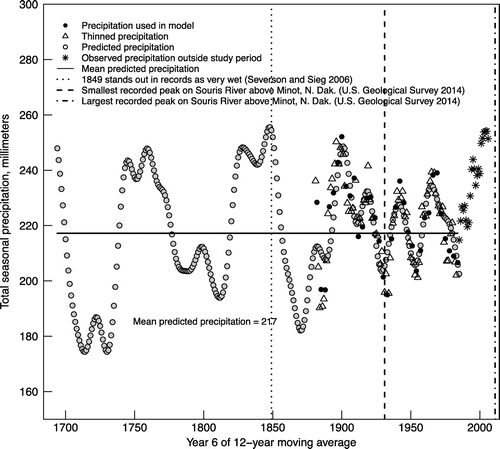
Figure 7. Group 5 (southern Manitoba and southeastern Saskatchewan), season 3 (July–October) modeled and observed 12-year moving average precipitation.
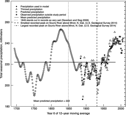
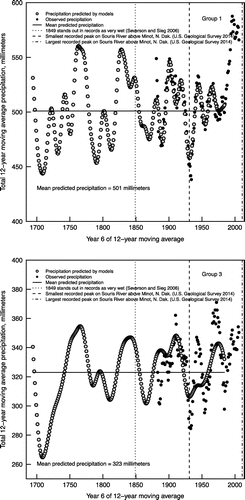
Figure 8. Twelve-year moving average annual precipitation for group 1 (southeast) and group 3 (southwest).