Publication Cover
Canadian Journal of Remote Sensing
Journal canadien de télédétection
Volume 41, 2015 - Issue 3
1,501
Views
22
CrossRef citations to date
0
Altmetric
Original Articles

Estimating Forest Site Productivity Using Airborne Laser Scanning Data and Landsat Time Series

, , , &
Pages 232-245 | Received 18 Nov 2014, Accepted 12 May 2015, Published online: 11 Sep 2015

Figures & data

Study area location. The hatched areas indicate where ALS was acquired in 2012.

Table 1 List of Landsat scenes used in the study

Table 2 ALS data characteristics

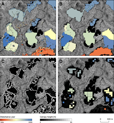
Figure 2 A representative subset of the study areas on which a method of finding sample units (100 × 100 m) in the detected stand-replacing disturbances is demonstrated. A: Disturbance areas (stands) detected with Landsat time series; B: Stands are generalized; C: The borders of the stands are refined using CHM; D: 100 × 100 m sample units are placed inside the stands.
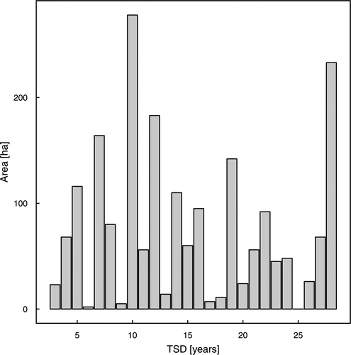
Figure 3 Distribution of time since disturbance (TSD) by area, for the sample units (n = 2006).
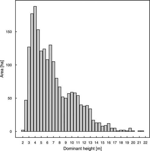
Figure 4 Histogram of dominant height calculated for the sample units (n = 2006).
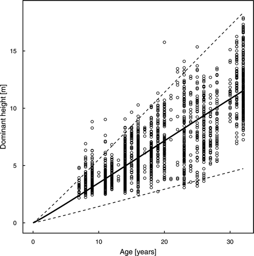
Figure 5 Guide curve fitted in the height-age measurements (95% confidence intervals presented as dashed lines).

Table 3 Result of the model parameter estimates

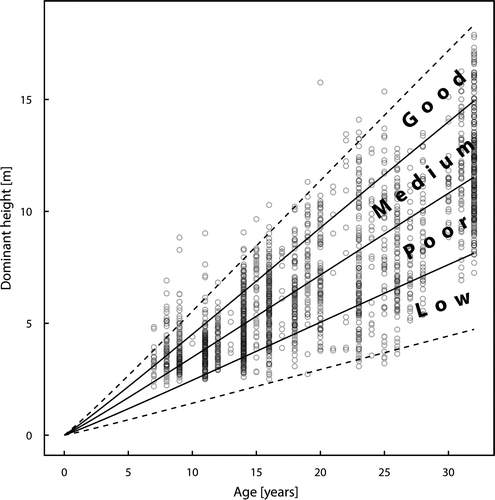
Figure 6 Derived site productivity classes plotted together with the height-age data used to construct them (dashed lines indicate 95% confidence intervals).
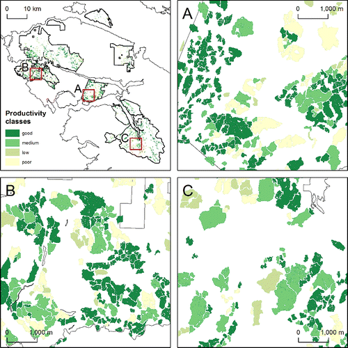
Figure 7 Site productivity map derived with the developed model. Three example areas (A, B, and C) shown in larger scale to demonstrate the spatial variability of the site productivity classes.

Table 4 The results of the comparisons of site productivity estimates

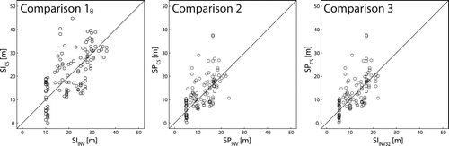
Figure 8 Scatterplots presenting the comparison of the productivity estimates in three sets. SI – site index calculated with equations used in British Columbia and input data from forest inventory (SIINV) or from chronosequence of dominant height values (SICS); SP – site productivity calculated with the developed model and input data from forest inventory (SPINV) or from chronosequence of dominant height values (SPCS); SIINV32 – site index calculated with inventory data for the reduced based age (32 years). In all sets n = 120.
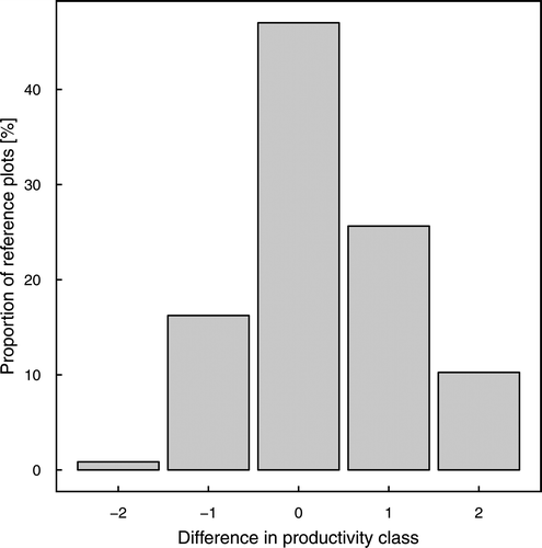
Figure 9 Distribution of the productivity class difference values (model-derived class – reference site class).