Figures & data
Fig. 1 Bottom topography and locations of hydrographic stations (◊) and Argo floats (○), constructed in October 2008. The three boxes used for inverse analysis are also indicated.
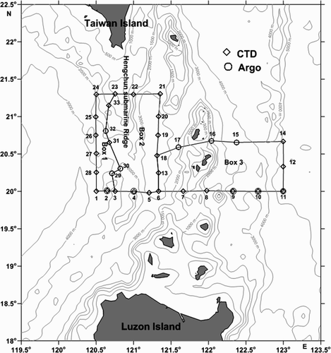
Fig. 2 Wind stress (N m−2) distribution over the region studied during October 2008.
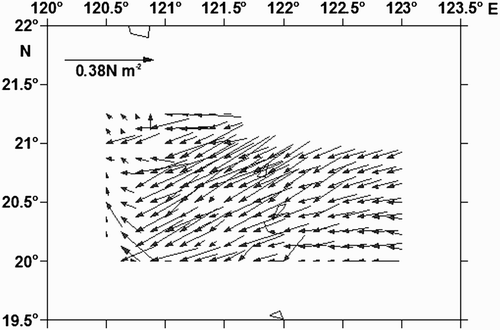
Fig. 3 (a) Horizontal distribution of the water temperature (°C); (b) salinity (practical salinity scale used); and (c) density (σt ) at 200 m depth in the region studied during October 2008.
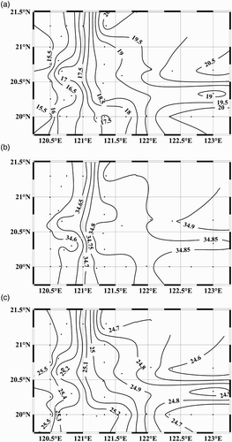
Fig. 4 As in except at 400 m depth.
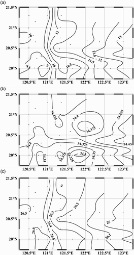
Fig. 5 As in except at 600 m depth (grey denotes the sea bottom).
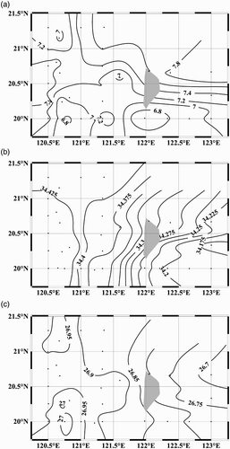
Fig. 6 T-S diagram for the hydrographic stations at (a) the southern and (b) the northern boundary of the region. Mean T-S diagrams in the yellow and red areas are also included to represent the SCS (yellow dashed) and upstream Kuroshio (red dashed) water. Different colours and shapes are used to identify hydrographic stations and corresponding T-S profiles for (a) the southern boundary and (b) the northern boundary of the region. Contour lines indicate potential density (kg m−3). The practical salinity scale is used.
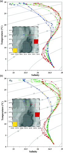
Fig. 7 Geostrophic currents (cm s−1) calculated from the merged absolute dynamic topography on (a) 15 October and (b) 17 December 2008. Data over the shelf shallower than 500 m have been masked.
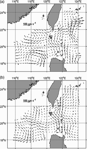
Fig. 8 Sectional distributions of velocity (cm s−1) at latitudinal (a) section 1–11, (b) section 14–18, and (c) section 21–24 determined by the modified inverse method in October 2008. Positive values indicate northward flow.
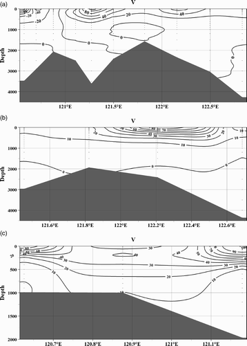
Fig. 9 Distribution of streamfunction and volume transport (Sv) in the study region in October 2008.
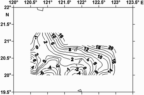
Fig. 10 (a) Currents determined from ADCP measurements in the surface layer (8–24.7 m) and (b) velocity vectors (cm s−1) at 10 m determined by the diagnostic model of the study region during October 2008.
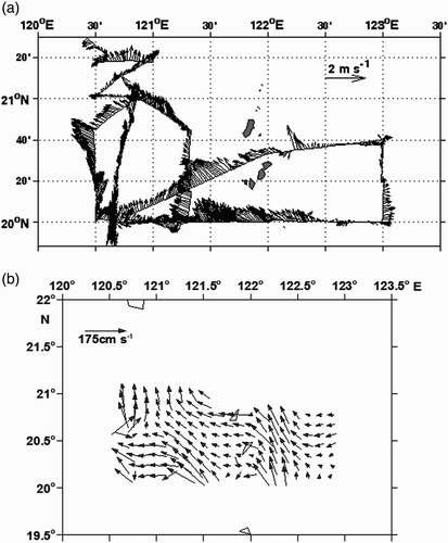
Fig. 11 As in b except at (a) 100 m, (b) 200 m, (c) 300 m and (d) 400 m depths.
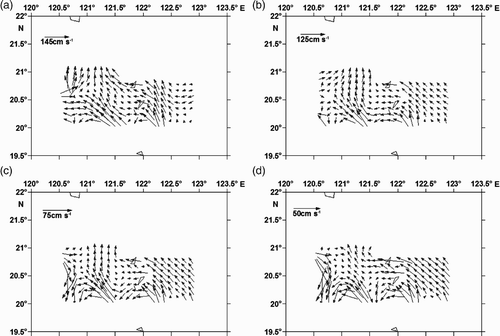
Fig. 12 As in except at (a) 500 m, (b) 700 m, (c) 1000 m and (d) 1500 m depths.
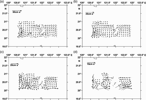
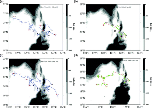
Fig. 13 (a) Trajectories of Argo floats 2901169, 290170, 2901171, 2901172 and 2901167 for the period 7 October to 18 December 2008 (▴: 7 October 2008; ⋆: 18 December 2008); (b) trajectory of Argo float 2901172 for the period 9 October 2008 to 7 January 2009 (green lines with solid dots: at the surface; red lines: at 1000 m; ▴: 9 October 2008; ⋆: 7 January 2009); (c) trajectory of the five Argo floats for the period 7 October 2008 to 5 January 2009 (▴: 7 October 2008; ⋆: 5 January 2009); and (d) trajectory of Argo float 2901172 for the period 9 October 2008 to 2 January 2010 (green lines with solid dots: at the surface; red lines: at 1000 m; ▴: 9 October 2008; ⋆: 2 January 2010).