Figures & data
Fig. 1 Spatial distributions of Argo float temperature and salinity profiles in the Northwest Pacific Ocean during the period 2003–07: (a) JFM, (b) AMJ, (c) JAS, and (d) OND. Winter, indicated by JFM, is regarded as the three consecutive months of January, February and March, and so on. The rectangle is the study area (16°N–25°N, 122°E–130°E).
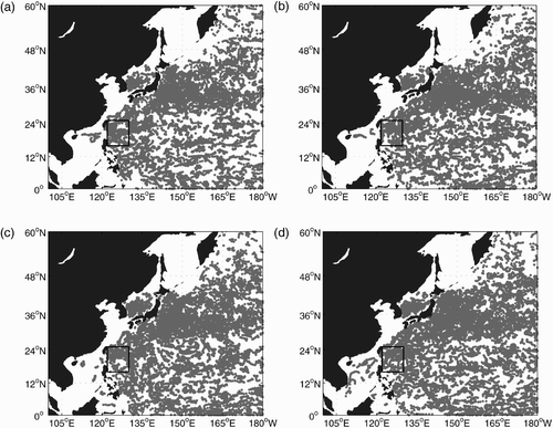
Fig. 2 Monthly accumulated number of Argo float profiles in the study region (16°N–25°N, 122°E–130°E) during the period 2003–07.
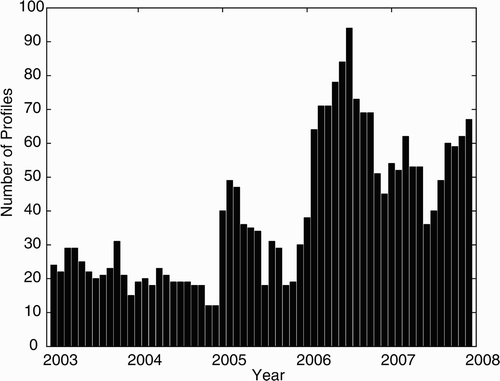
Fig. 3 Spatial distribution of Argo profiles during the period 2003–07.
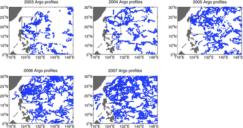
Fig. 4 Temperature-salinity (T-S) diagrams from the Argo float profiles in the study area from 2003 to 2007, superimposed on these are the annual mean T-S curves for the year 2003 (yellow solid line), 2004 (magenta solid line), 2005 (red solid line), 2006 (green dashed line) and 2007 (blue solid line).
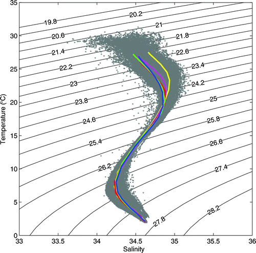
Fig. 5 Time evolution of salinity profiles (a) along 18°N from 122°E–130°E and (b) along 126°E from 16°N–25°N in the study area based on Argo observations from 2003 to 2007. (c) and (d): as in (a) and (b), but for ECCO outputs. The corresponding mean depth of σθ = 23.8–24.0 kg m−3 is depicted by the grey line.
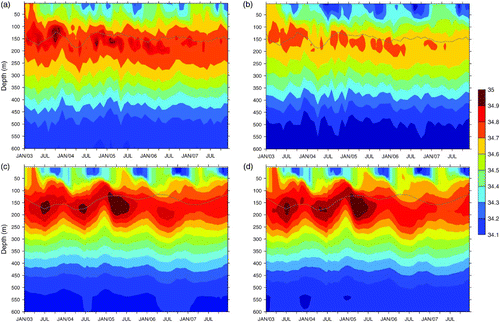
Fig. 6 Spatial distributions of salinity anomalies of σθ = 23.8–24.0 kg m−3 from 2003 to 2007: (a) Argo and (b) ECCO. The corresponding flow fields are indicated by black arrows.
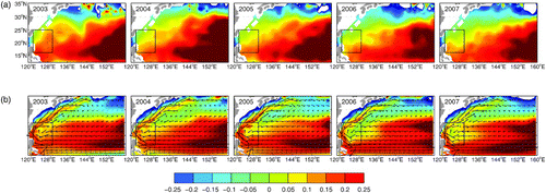
Fig. 7 Three-month mean evaporation minus precipitation (cm yr−1, colour scale) and surface winds (arrows) for (left panels) 2003, (middle panels) 2004 and (right panels) 2007; upper panels are for December–February; lower panels are for June–August.
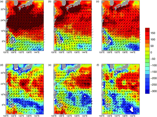
Fig. 8 Spatially averaged monthly mean precipitation and evaporation during the period 2003–07 in the study area (16°N–25°N, 122°E–130°E). The solid line denotes precipitation; the dashed line denotes evaporation. Both are in units of cm mo−1.
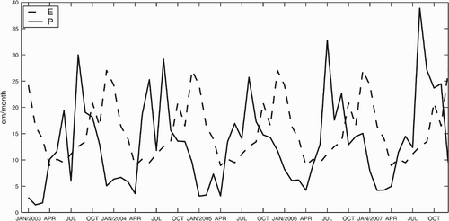
Fig. 9 Depth of the mixed layer in winter derived from Argo (dots) and ECCO (black lines) by the shallowest extreme curvature method (Lorbacher et al., Citation2006) for (a) 2003 and (b) 2007.
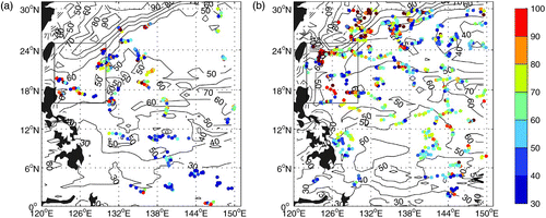
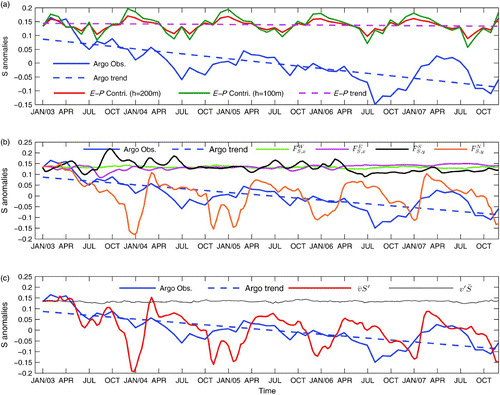
Fig. 10 (a) Salinity anomaly from Argo observations and model predictions (Eq. (5)) for the upper ocean in the study area from 2003 to 2007. The Argo observed salinity anomaly (averaged over 0–200 m in the study area (blue line) and its trend (derived using the linear least squares technique; blue dashed line); salinity change induced by the surface freshwater flux (E–P) based on the one-dimensional model (Eq. (5)) (red line for h = 200 m, green line for h = 100 m). The pink dashed line represents the trend in salinity change as a result of the surface freshwater flux (E–P), with h = 200 m. (b) Salinity anomaly from Argo observations and model prediction (Eq. (6)); the salinity anomaly from Argo observations and its trend are denoted by the blue and blue dashed lines, respectively; ,
,
, and
are the contributions from the salt flux through the western, eastern, southern and northern boundaries, respectively. (c) Salinity anomaly from Argo observations (blue line) and the meridional salinity flux along the southern and northern boundaries (
and
), which are denoted by the red and black lines, respectively.