Figures & data
Fig. 1 Seasonal distribution of Argo profiling floats from 2006 to 2010 in (a) spring (the black line shows the Taiwan–Ishigakijima section and the star denotes Ishigakijima island), (b) summer, (c) fall and (d) winter.
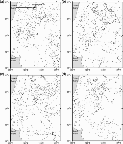
Fig. 2 Seasonal mean wind velocity in (a) spring, (b) summer, (c) fall and (d) winter.
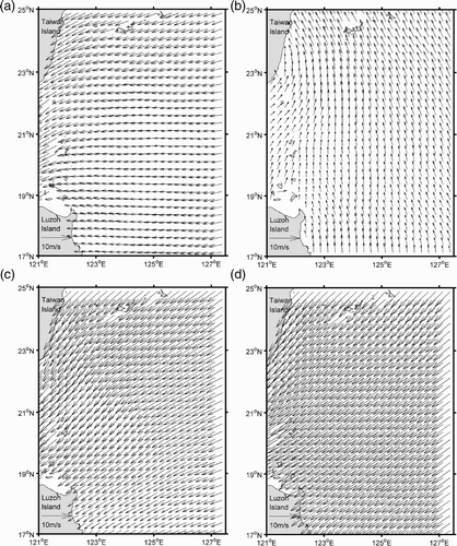
Fig. 3 T-S diagram from Argo data in the northwestern Pacific Ocean from 2006 to 2010 in (a) spring, (b) summer, (c) fall and (d) winter. The curves in red are fitted using the least squares method. The lines of constant density are shown in the figure.
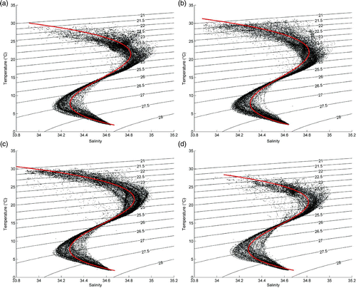
Table 1. Seasonal mean MLD for 2006–10.
Fig. 4 Distribution of the multi-year seasonal mean MLD (units are metres) in (a) spring, (b) summer, (c) fall and (d) winter.
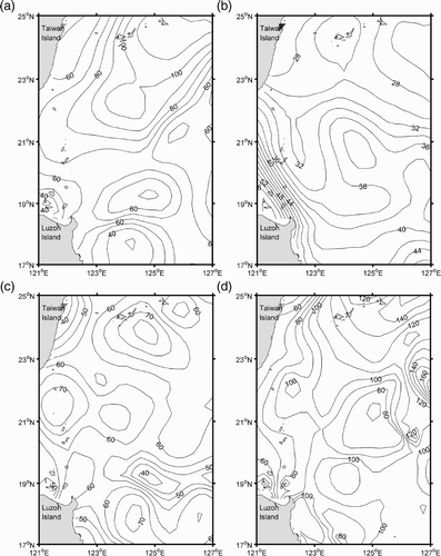
Fig. 5 Current field in spring. (a) current field at 10 m computed from Argo data, (b) current field at 200 m computed from Argo data, (c) geostrophic current field extracted from altimetric data, and (d) current field at 10 m computed from Levitus data.
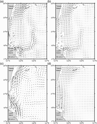
Fig. 6 As in but for summer.
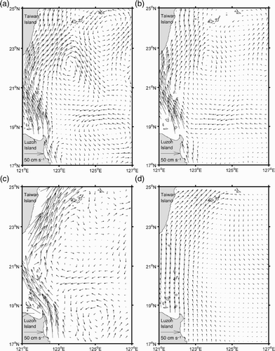
Fig. 7 As in but for fall.
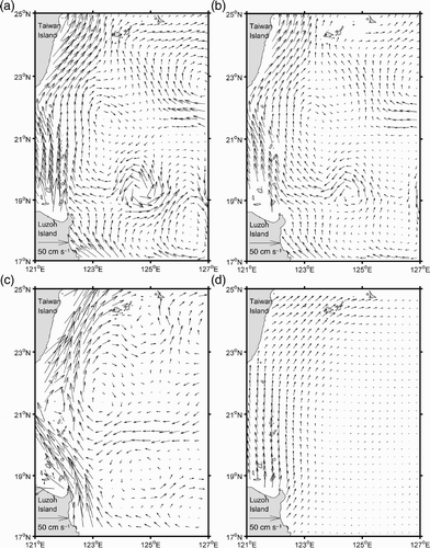
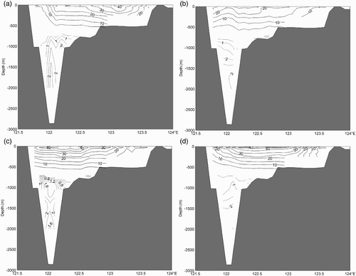
Fig. 8 As in but for winter.
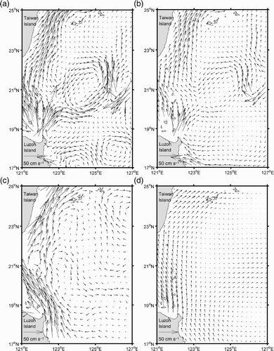
Fig. 9 Vertical distribution of the combined seasonal longitudinal current (obtained from the current derived from Argo data with the Ekman drift current) speed contour along the section east of Taiwan Island shown in a (units cm s−1; the black contours denote the northward current while the grey contours denote the southward current) in (a) spring, (b) summer, (c) fall and (d) winter.