Figures & data
Fig. 1 Map of the area over which the composite currents were calculated. The Flemish Cap transect is shown with a thick line. Major currents are also shown schematically. Abbreviations are Nfld. = Newfoundland and FC = Flemish Cap. The depth contours are for the 200, 1000 and 3000 m depths.
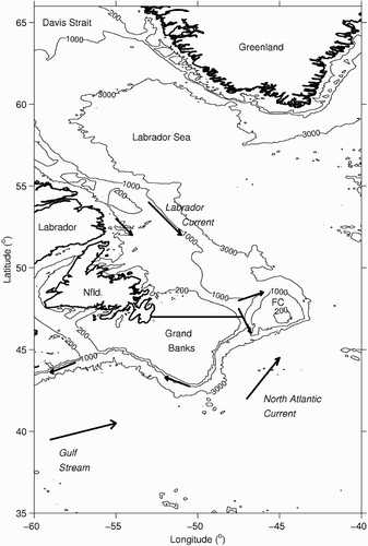
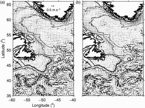
Fig. 2 Long-term mean surface currents: a) satellite-derived; b) numerically simulated (z = −0.6 m); c) combination of the satellite-derived and numerically simulated fields; d) combination of the currents shown in c) and the long-term mean of wind-driven currents (z = 0 m). In this and subsequent plots, the current vectors are shown at every other location (i.e., at 0.5° resolution).
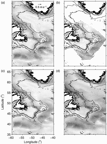
Fig. 3 Similar to to 2d, but for 15 m depth.
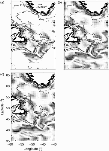
Fig. 4 a) Weekly mean composite 15 m depth currents (black arrows) and buoy-derived observed currents (red arrows); b) altimetry-derived geostrophic currents; c) wind-driven currents, and d) the Ekman component of c), for the week centred on 2 October 2002.
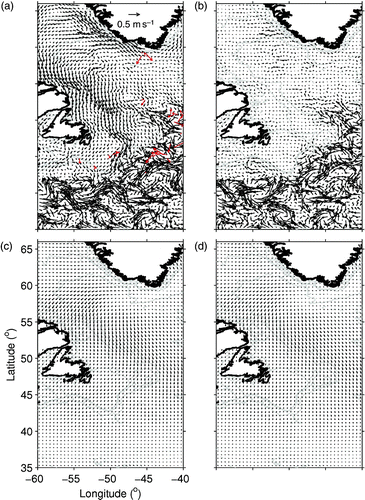
Fig. 5 Similar to , but for the week centred on 16 October 2002.
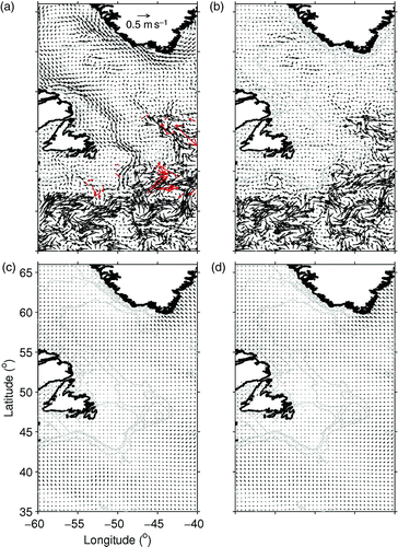
Table 1. Statistics comparing weekly-mean near-surface (15 m) composite currents to buoy-observed currents. See text for definitions of regions and Eqs (11) and (12) for definitions of SDR and VDR, respectively. R is the correlation between current velocity components (p = 0 in all cases).
Table 2. Similar to , but for composite currents calculated without the wave-induced (Stokes) component.
Table 3. Similar to , but for composite currents calculated using only the satellite-derived part of the mean current field.
Table 4. Statistics comparing ADCP-observed currents over the Flemish Cap transect (averaged over 0.25° intervals) and composite currents averaged spatially and temporally to locations and times of the averaged observed currents.
Fig. 6 Currents along the Atlantic Zone Monitoring Program's Flemish Cap transect: a) observed at 17 m depth by shipboard ADCP from 2 to 3 July 1993, averaged over 0.25° intervals; b) composite currents at 17 m depth interpolated spatially and temporally to locations and times of the currents in a); c) composite currents using only the satellite-derived long-term mean currents. The arrow at the upper right denotes the cruise direction.
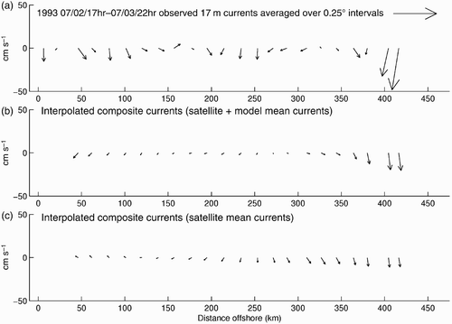
Fig. 7 Similar to , but for 15 to 16 July 1995, at 13 m depth.
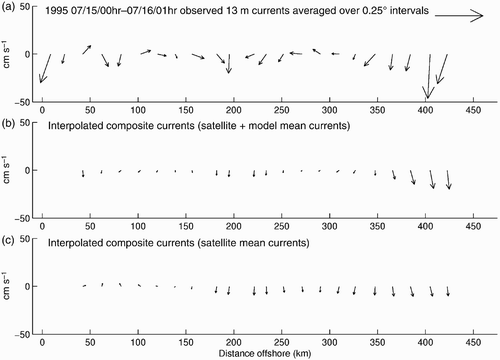
Fig. 8 Similar to , but for 20 to 21 November 2001, at 12 m depth.
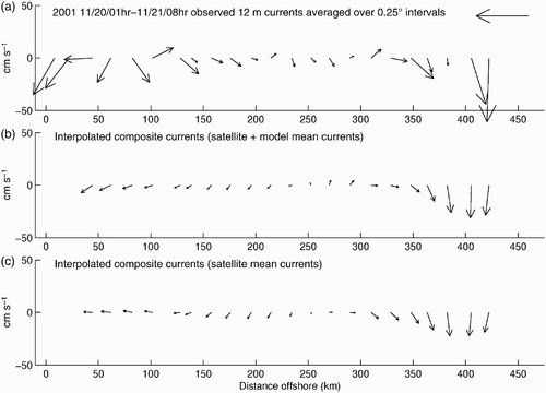
Fig. 9 Similar to , but for 24 to 25 April 2002, at 20 m depth.
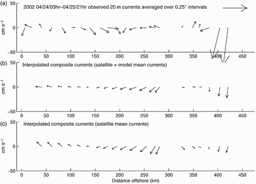
Table 5. Statistics comparing six-hourly composite currents calculated at the surface to drifter-observed surface currents. The composite currents were calculated with and without Stokes drift. 448 observations were used.
Fig. 10 Five-day-mean, 1/3° resolution OSCAR currents interpolated to the composite current grid, for the five-day periods centred on a) 1 October 2002 and b) 16 October 2002.