Figures & data
Table 1. Temperature, salinity, and density trends at three lighthouse stations well exposed to the open ocean. F90 and F97 are the trends reported in the previously cited studies.
Fig. 1 This map shows the principal locations used in the paper. Amphitrite Point, Kains Island, and Langara Island are lighthouses where sea-surface temperature and salinity have been observed daily since the mid-1930s. The dots in the offshore regions show the locations of stations comprising Line-P. Station P26 is more commonly known as Ocean Station Papa.
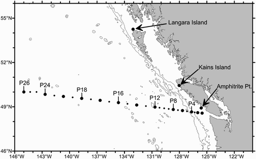
Fig. 2 Sampling at Ocean Station Papa (P26) in the upper panel. In the lower panel the distribution of samples as shown after the sampling along Line-P is augmented with interpolations using Argo data.
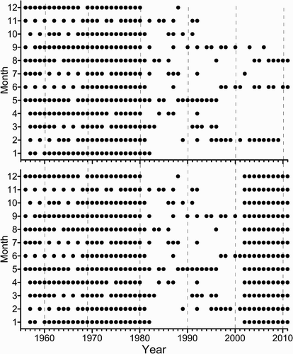
Fig. 3 Trends in scalar properties computed at station P26 versus depth.
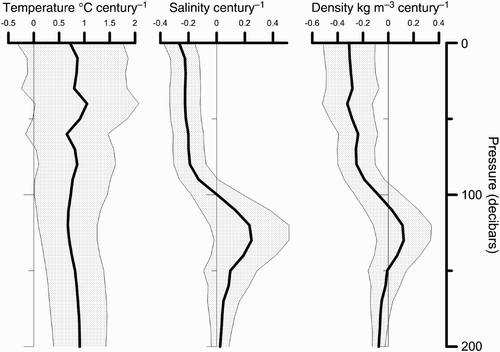
Fig. 4 Monthly density trends (averaged over the interval 0–80 db) at station P26.
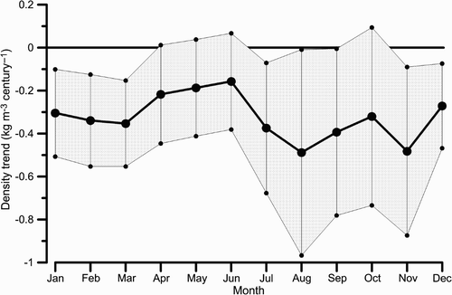
Fig. 5 Density anomaly trends (kg m−3 per century) along Line-P averaged over all months of the year; the symbols above the top axis indicate the location of the stations used.
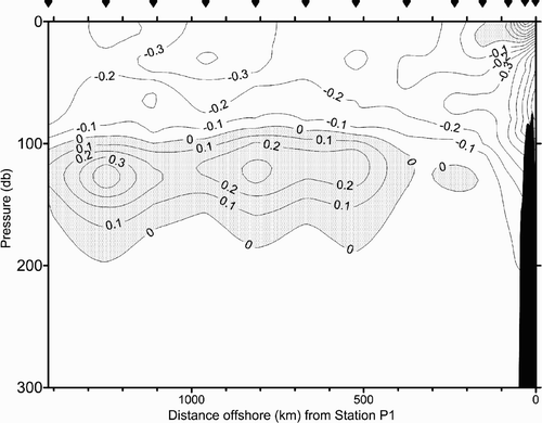
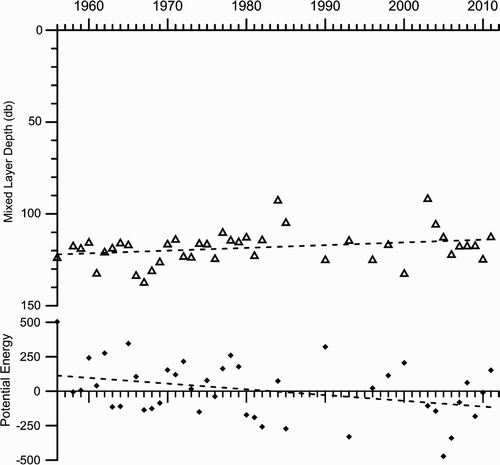
Fig. 6 The mid-winter mixed-layer depths at station P26 (Ocean Station Papa) in the upper panel and a parameter proportional to the potential energy of the water column.