Figures & data
Figure 1 Sample sites on the James River arm of Table Rock Lake, in southwestern Missouri, USA. The James River arm meets the main stem (White River) near site 9. Inset map of the upper White River lakes courtesy of W.R. Green. The horizontal line represents the Missouri-Arkansas border.
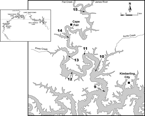
Figure 2 Limnology of Table Rock Lake, James River arm, site 9, January 2002–May 2004. Temperature is shown as the smooth line and Secchi depths as the lines extending from the top. Stratified periods are shown as boxes at the bottom, with low oxygen (< 1 ppm) hypolimnion indicated by darker shading.
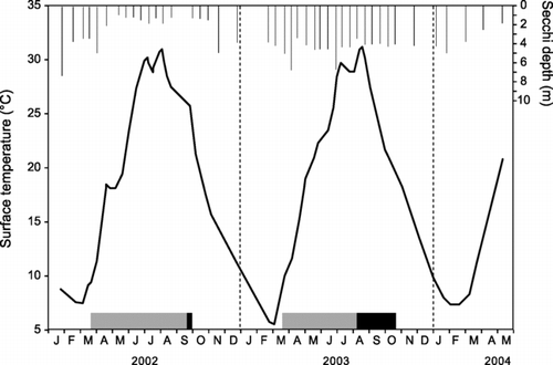
Figure 3 Transparency at 7 sites, arranged from down-lake to up-lake, on Table Rock Lake, James River arm. Each site was visited on 41 dates, January 2002–May 2004. Variation at each site (among dates) is indicated with Box-Whisker plots: box shows median ± first and third quartiles, whiskers show 1.5 times the inter-quartile range, and dots are outliers.
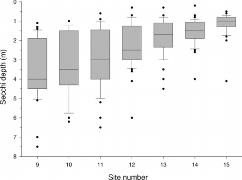
Table 1 Algal genera and frequency of occurrence in the James River Arm of Table Rock Lake, January-December 2003. Total sample dates = 20, total genera = 69. Those genera labeled with an asterisk are known to cause nuisance blooms or taste and odor problems (CitationCarmichael 1981, CitationChorus and Bartram 1999, current study).
Figure 4 Algae population dynamics (as density), by major group, at Table Rock Lake, James River arm. Note different scales for the two graphs. To simplify display, chlorophytes, cryptomonads, and euglenoids are pooled into a single group (“Greens”).
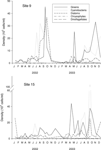
Figure 5 Algae population dynamics (as biovolume), by major group, at Table Rock Lake, James River arm.
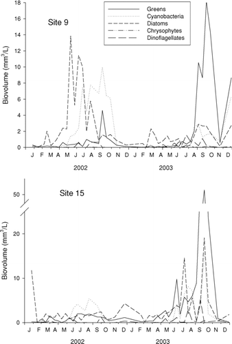
Figure 6 Zooplankton population dynamics, by major group, at Table Rock Lake, James River arm.
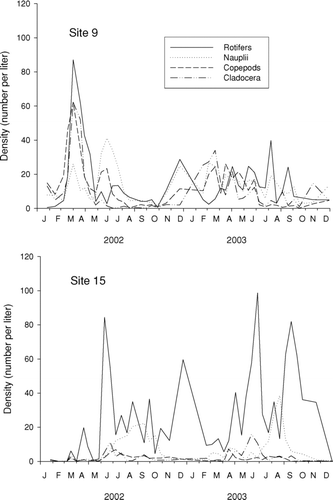
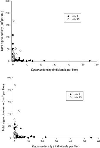
Figure 7 Association between total algae abundance and density of Daphnia.