Figures & data
Figure 1 Location of the South Lake Tahoe, CA, study area.
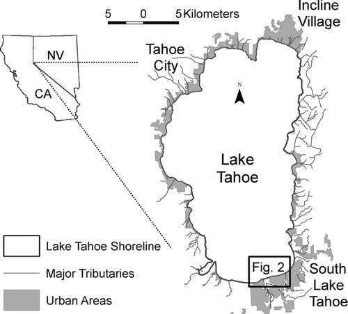
Figure 2 Nearshore area by the City of South Lake Tahoe. The locations for the turbidity transects at distances of 0.5 and 1.0 km from the shore (marked with a bold line) are shown by dashed lines. The large black dot marks the location approximately 250 m offshore from the outlet of the Upper Truckee River where water samples were collected for particle composition analysis.
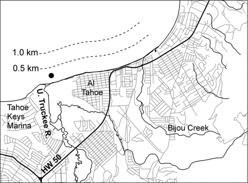
Figure 3 Transects of turbidity at 0.5 and 1.0 km offshore along 3.5 km between the outlet of the Upper Truckee River outlet and east of Bijou Creek South Lake Tahoe for 5 dates (see and ).
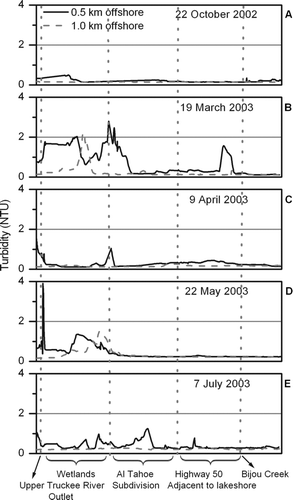
Figure 4 Upper Truckee River discharge recorded at the US Geological Survey gage (station number 10336610) in South Lake Tahoe (top). Distance in a perpendicular direction from the lakeshore where elevated and high turbidity values were recorded (bottom) during the study period July 2002–August 2003.
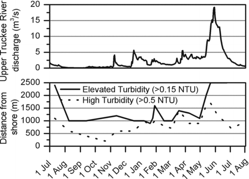
Table 1 Weather conditions preceding the 5 survey dates that were selected to exemplify typical, calm fall conditions, spring precipitation events, spring snowmelt, and calm summer conditions. This is a subset of the 23 surveys conducted in 2002 and 2003.
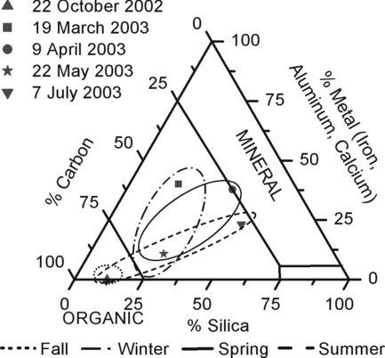
Figure 5 Particle composition from water samples collected approximately 250 km offshore South Lake Tahoe (see ) on 5 dates described in . Samples composed of up to 25% silica and 75% carbon were considered organic material, while samples composed of 10% metals were of mineral origin. Seasonal circles were derived from the full set of 14 samples collected at this site. For clarity, only the samples from the dates in are shown.