Figures & data
Figure 1 Lake Mead and the 3 sampling stations in Boulder Basin.
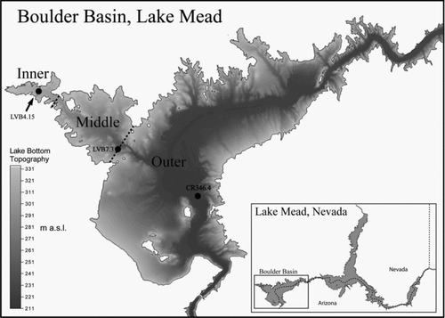
Figure 2 Lake Mead surface elevation (solid line) and total phosphorus (TP) discharge (triangle connected with dashed line) from Las Vegas Wash to Las Vegas Bay (triangle) from 1990 to 2009. Data for water surface elevation is from www.usgs.gov; data for TP loading was provided by Dr. Douglas Drury.
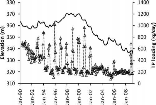
Figure 3 Chl-a concentrations at the 3 sampling stations in Boulder Basin of Lake Mead from 2002 to 2008.
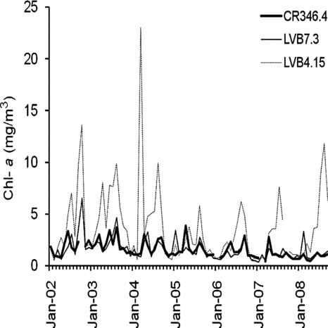
Figure 4 Chl-a concentrations within Boulder Basin before (2002–2006) and after (2007–2008) quagga mussel invasion (different letters on top of the bar in the same station show significant differences).
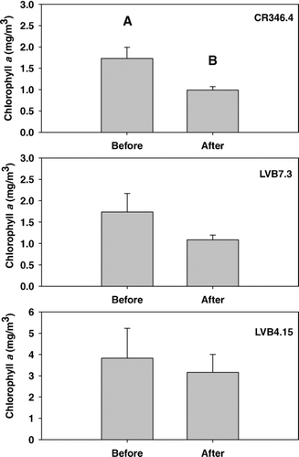
Figure 5 Temporal trend of Chl-a concentration (triangle and dashed line, Y = 364.1 − 0.181 X (R2= 0.85)) and OP concentration (dark square and solid line, Y = 832.2 − 0.414 X (R2= 0.84)) at CR346.4 of Boulder Basin. Primary Y-axis represents Chl-a, secondary Y-axis represent OP concentration and X-axis represents year.
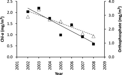
Figure 6 Secchi depths at the 3 sampling stations in Boulder Basin of Lake Mead from 2002 to 2008.
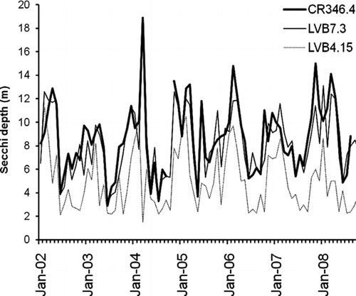
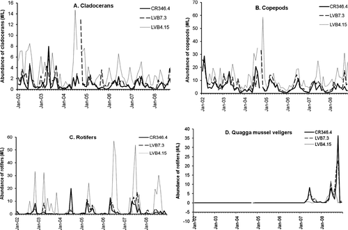
Figure 7 Zooplankton abundance (#/L) at the 3 sampling stations in Boulder Basin of Lake Mead from 2002 to 2008. A: cladocerans; B: copepods; C: rotifers; and D: quaggga mussel veligers.