
Figures & data
Figure 1. Tambo–Santiago–Ica river basin map, Perú and South America.
Source: Adapted from Ministerio del Ambiente (MINAM) (Citation2020, p. 18).
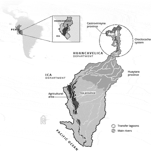
Table 1. Irrigated area in Ica province by water source.
Figure 2. Water flows and water users in the Tambo–Santiago–Ica river basin: relationship between water sources and water users during the rainy and dry seasons.
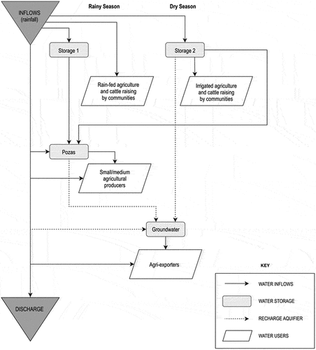
Figure 3. Infrastructure investments and side-payments.
Note: The initial allocation leads to benefits depicted by point M. Initial investments have shifted water to downstream, increasing their benefits at the expense of upstream, illustrated by point d. New joint investments create a bargaining situation with Nash bargaining solution (NBS) at point L where the highest feasible social welfare level H is reached; see the dotted hyperbola. Side-payments (water trade) can further improve benefits and the NBS becomes N, located on the social welfare level represented by the H´ curve. Point P indicates the efficient water allocation without side-payments. Points K and K´ are the Kalai–Smorodinsky (KS) solutions for the respective bargaining sets. New joint infrastructure investments create a bargaining situation. Two solutions are applied to assess welfare changes: NBS and KS. The former focuses on sharing the net gains such that the highest level of social welfare is achieved. The latter uses the ratio of the aspiration levels to the agents. Side-payments allow to enlarge the bargaining set and improve welfare.
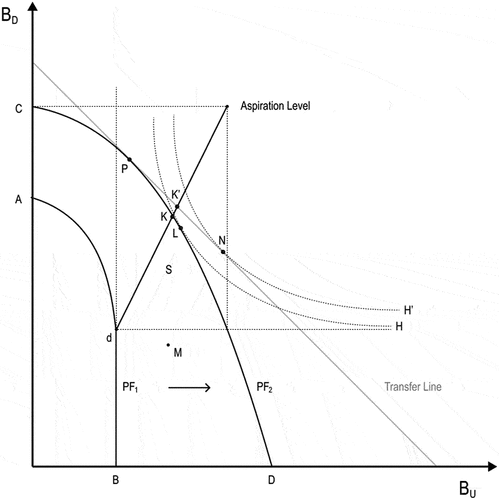
Table 2. Summary of solutions: Nash bargaining solution (NBS) and Kalai–Smorodinsky (KS).
Supplemental material