Figures & data
Figure 1. Map of Fennoscandinavia with the counties of northern Sweden marked out. According to fourteenth-century records, the parish of Bygdeå formed the northern frontier of the “settled” area. Areas further north and northwest were regarded as wasteland or inhabited by “hunters in forests and lakes”.
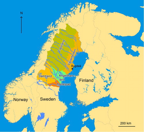
Figure 2. Map of the study area with the parishes marked out: (1) Umeå parish, (2) Bygdeå parish, (3) Lövånger parish, (4) Skellefteå parish, (5) Piteå parish, (6) Luleå parish, (7) Kalix parish and (8) Torneå parish. Localities mentioned in the text are marked as filled triangle.
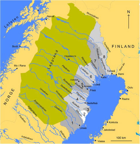
Figure 3. Villages in Västerbotten county (corresponding to today’s Norrbotten and Västerbotten counties) according to the tax register of 1543, marked as open circle. The villages involved in interior lake fishing in 1553 are marked as filled triangle and those engaged in seal hunting with filled circle.
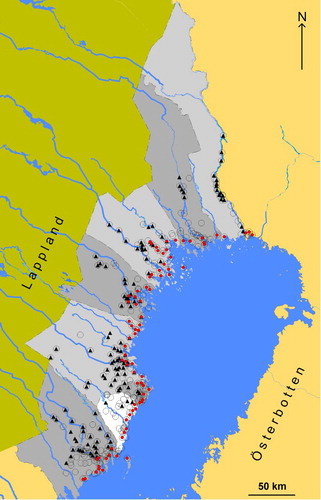
Figure 4. The number of interior fishing lakes per parish in 1553.
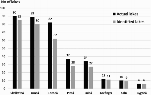
Figure 5. The number of interior lakes per village used for fishing.
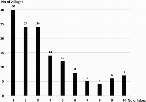
Table 1. The share (%) of villages per parish involved in interior lake fishing in 1553.
Figure 6. The percentages of different species in relation to the total catch of 100,741 kg (fresh weight) in 1553.
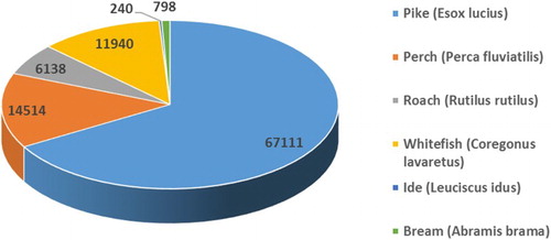
Table 2. The amount of fish (fresh weight) per species and parish in 1553.
Figure 7. The variable composition of teams fishing in lake Storträsket during the period 1553–1557.
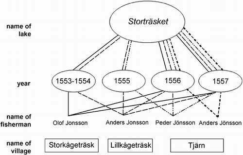
Table 3. The index number of fishers per parish and the mean number per village and parish, based on the 1553 record.
Figure 8. Map of villages (grey dots) and their respective interior lakes (dark squares) connected with lines, based on the 1553 taxation record. Villages not engaged in interior lake fishing are marked with black dots.
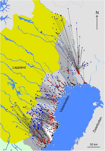
Figure 9. Woodcut showing a fisherman harvesting a catch of pike. The birds in the upper right of the picture are probably sea birds, indicating that fishing took place in late spring and early summer. The buildings in the upper part of the picture are possibly depictions of huts and storage buildings at a fishing camp (from Magnus [Citation1555] Citation1982, 947).
![Figure 9. Woodcut showing a fisherman harvesting a catch of pike. The birds in the upper right of the picture are probably sea birds, indicating that fishing took place in late spring and early summer. The buildings in the upper part of the picture are possibly depictions of huts and storage buildings at a fishing camp (from Magnus [Citation1555] Citation1982, 947).](/cms/asset/f676a88d-a397-4eef-9fdd-63e6f452e915/sabo_a_1390662_f0009_b.gif)
Table 4. The number of villages and farms engaged in interior lake fishing in each of the parishes including the total amount of fish (dry weight) per parish and the index value of fish per farm if equally distributed among village farms.
Figure 10. Schematic outline of the settlement development in connection with interior lake fishing.
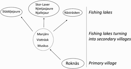
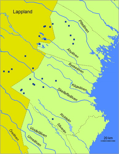
Figure 11. Map showing lakes with Sámi names, or first elements in Sámi, used by coastal fishermen from the Piteå and Skellefteå parishes (Pellijeff Citation1988, 72, 85–87; Berggren Citation1995, 67; Lundström Citation2004, 54–61; Korhonen Citation2009, 205–234).