
Figures & data
Figure 1. A Child’s Lodge – Piegan c1926, Blackfoot Tipis, c1926, Kainai Tipi c1927. (Photographs: Edward Curtis. Public Domain.).
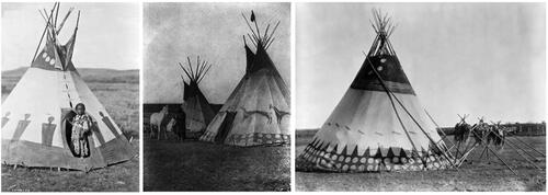
Figure 2. Blackfoot Confederacy Territory – depicting the part of North America now designated as Alberta, Saskatchewan, and Montana, where this knowledge was shared, or transferred. (Print of original artwork by Api’soomaahka [Running Coyote] William Singer III which he painted for Red Crow Community College 1993. Used with permission by the artist.).
![Figure 2. Blackfoot Confederacy Territory – depicting the part of North America now designated as Alberta, Saskatchewan, and Montana, where this knowledge was shared, or transferred. (Print of original artwork by Api’soomaahka [Running Coyote] William Singer III which he painted for Red Crow Community College 1993. Used with permission by the artist.).](/cms/asset/4adf0296-f61e-49df-ba55-d03c73d951ca/usnr_a_2180696_f0002_c.jpg)
Figure 3. Where the Belly River and the Old Man River become friends (Google Earth aerial photograph. Open source.).
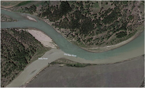
Table 1. Indigenous collective methods in relation to quantitative and qualitative analytical frameworks