
Figures & data
Figure 1. Table outlining key features of three districts.
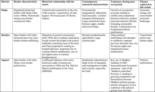
Figure 2. Map of Nepal showing new provincial boundaries (adapted by the authors from Ministry of Land Management, Cooperatives and Poverty Alleviation).
Notes: This new map has been approved by the government after consultation with other political parties. It also reflects Nepal’s claim to a 370 square km strip in the far west region, which is disputed by India (see Shakya Citation2020).
