Figures & data
Figure 1. (a) Location of the study area and block boundaries from Reilinger et al. (Citation2006) and Djamour et al. (Citation2011). (b) Seismotectonic map of Lake Van Basin and its surroundings (fault from Karakhanian et al., Citation2004; Koçyiǧit et al., Citation2001) (earthqukae from Ambraseys & Finkel, Citation1995; Ergin, Güçlü, & Uz, Citation1967; Soysal, Sipahioğlu, Kolcak, & Altınok, Citation1981; Tan, Tapırdamaz, & Yörük, Citation2008).
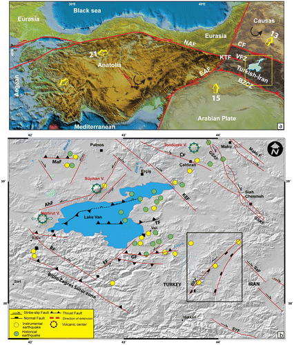
Figure 2. (a) Sketch map of the geology of the Başkale basin (Ateş et al., Citation2007). (b) Digital elevation model of the study area, including the Çamlık travertine in the Başkale basin.
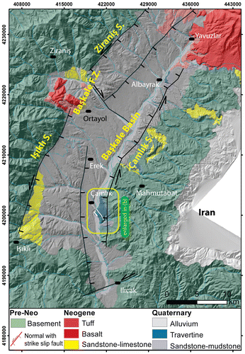
Figure 3. (a) Some of the major active faults in Başkale Basin. (b) Panaromic view of the Işıklı fault the red diamond symbol represents the morphological line of IF. (c) Google Earth™ image showing the detailed geometry of the IF Segment. (d) Panaromic view of the Çamlık fault and Çamlık fissure-ridge travertine.
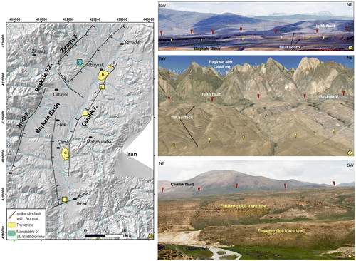
Figure 4. (a) Morphotectonic map for the fissure ridge area of Başkale basin. (b) The rose diagram shows the azimuthal distribution of fissure ridge long axes and the strike of the master normal faults. (c) Strike of the main fissure at the top of the ridge measured at the indicated positions along the fissure ridge.
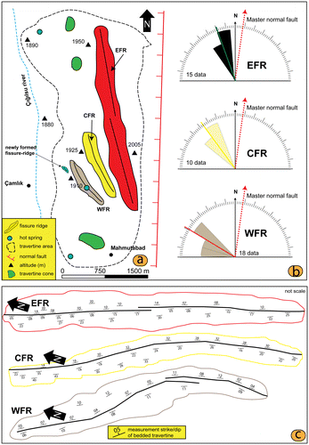
Table 1. Data for fissure ridges from 1EFR, 2CFR and 3WFR.
Figure 5. (a) Cross-sectional view of the EFR, showing banded travertines in the central fissure, and bedded travertines in the slope. (b) The central fissure of a ridge. (c) Bedded travertine of the EFR containing alternating colours and textures of travertine.
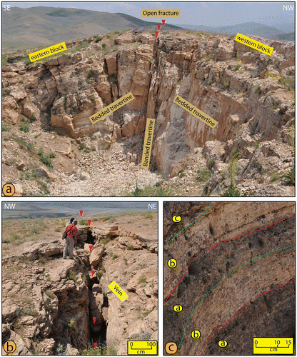
Figure 6. (a, b) Views of the CFR from the top of the ridge. (c) Width of the bedded travertine. (d) Black coloured travertine band within the bedded travertine.
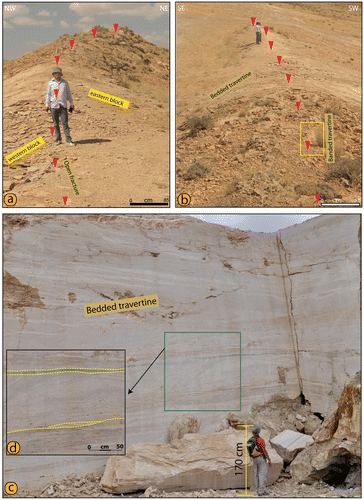
Figure 7. (a, b) Views of the CFR from the top of the ridge. (c) Central fissure of the ridge. (d) Active of travertine pool upon the ridge. (e) Inactive travertine pool upon the ridge.
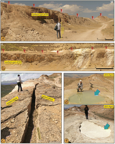
Figure 8. (a) Cross-sectional view of the WFR, containing banded travertines around the central fissure and bedded travertines in the slope. (b) Schematic illustration showing the development of the fissure-ridge travertine. (c) Width of the banded travertine. (d) New fissure-ridge travertine to the west of the existing ridge.
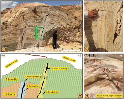
Figure 9. (a) Close-up views of the Çamlık fault and stereographic plots of slip-plane data measured on slickensides of the fault. (b) View of the second fault in Başkale basin. (c) Azimuthal relationship between faults and associated fissure ridges from. Rose diagrams of fissure ridge azimuth for: EFR, CFR and WFR. In the rose diagrams, the direction of present extensions is also plotted. (d) Rose diagrams show stress direction of measured along the Çamlık fault and long axis of FRTs .The Red open arrows the compressional and blue directions extensional directions.
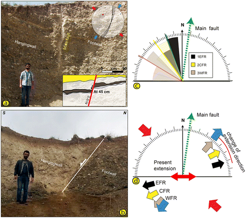
Figure 10. Diagram of Δα versus length of fissure ridges. Δα is the angular separation between the strike of the master normal fault and the strike of fissure ridges.
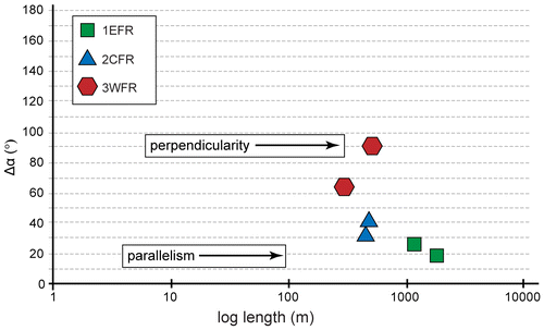
Table 2. U-Th measurements for fissure travertines in the Başkale basin, eastern Turkey. (δ234U = {(234U/238U)activity − 1} × 1000.
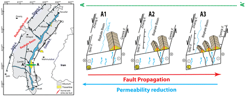
Figure 11. Schematic illustrations, based on our field data, developing of the Çamlık travertine, which is influenced under change of the tectonic regime in Başkale basin, resulting in the progressive migration of the three FRTs.