Figures & data
Figure 1. Spatial location of Riyadh districts in Saudi Arabia.
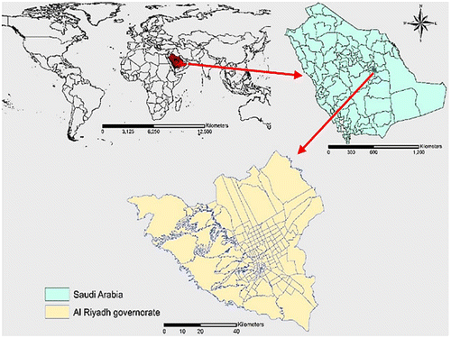
Figure 2. The distribution of public health facilities across Riyadh districts.
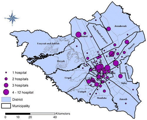
Figure 3. The result of average nearest neighbor for public health facilities.
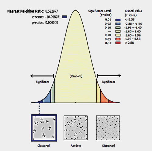
Figure 4. Percentage of public health facilities in each district.
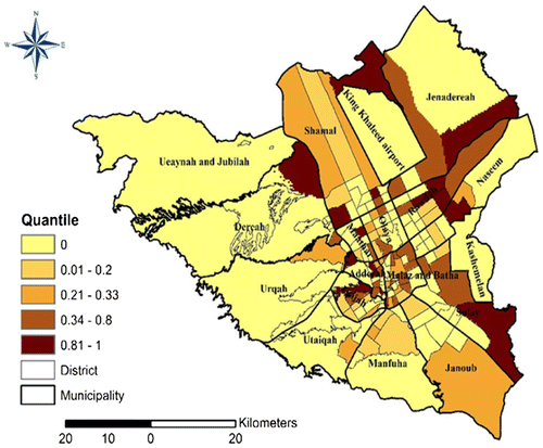
Figure 5. Spatial accessibility to closest public health facility.
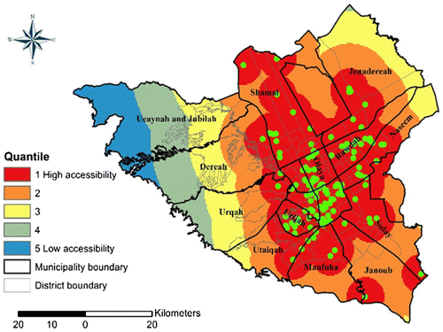
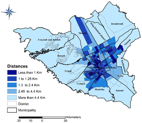
Figure 6. Average distance to closest public health facility within Riyadh districts.
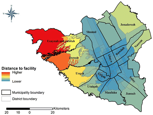
Figure 7. 1-km served area of public health facility in Riyadh districts.
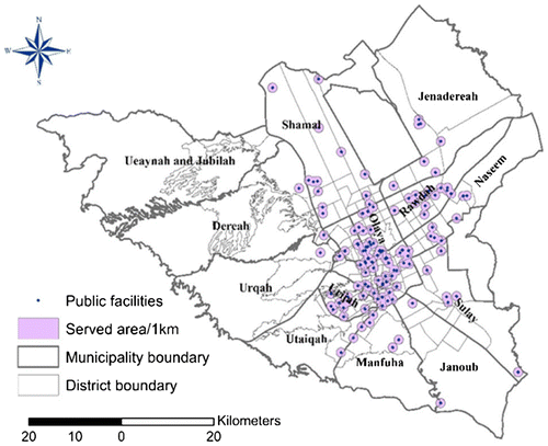
Figure 8. Frequency of percent of unserved area in each district within 1-km health facility radius.
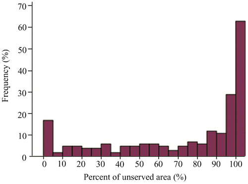
Figure 9. Population to health facility ratio (districts with very low population size are geographically very large).
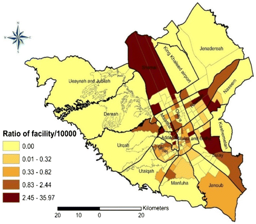
Figure 10. Distance from population locations to nearest public health facility (supply).