Figures & data
Figure 1. Constructing high-quality 3D urban model.
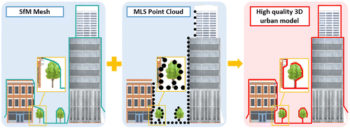
Figure 2. Algorithm of our registration method.
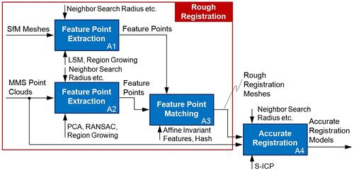
Figure 3. Hash table generation of rough registration.
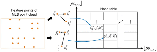
Figure 4. Search process and matching evaluation of rough registration.
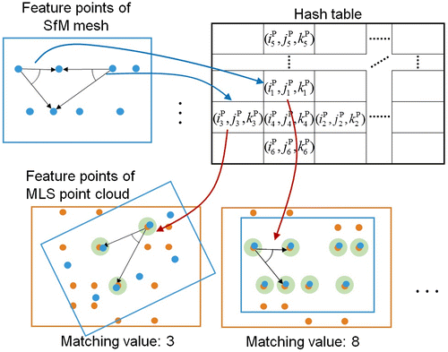
Figure 5. Experimental results of Data-set 1. (a) Aerial view of the MLS point cloud (left) and SfM mesh (right). (b) Input data from two viewpoints (pink: SfM mesh, colored points: MLS point cloud). (c) The vertical edges and extracted feature points (left: MLS point cloud, right: SfM mesh). (d) Rough registration result (left) and accurate registration result (right). (e) The distance from the vertex of the SfM mesh to its nearest point of the MLS point clouds is colored (left: rough registration, right: accurate registration).
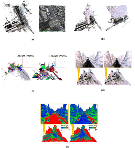
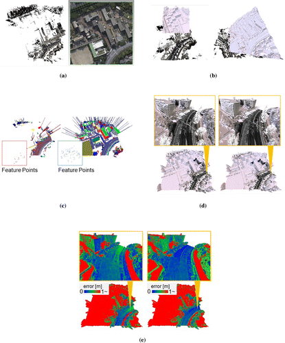
Figure 6. Experimental results of Data-set 2. (a) Aerial view of the MLS point cloud (left) and SfM mesh (right). (b) Input data from two viewpoints (pink: SfM mesh, colored points: MLS point cloud). (c) The vertical edges and extracted feature points (left: MLS point cloud, right: SfM mesh). (d) Rough registration result (left) and accurate registration result (right). (e) The distance from the vertex of the SfM mesh to its nearest point of the MLS point clouds is colored (left: rough registration; right: accurate registration)
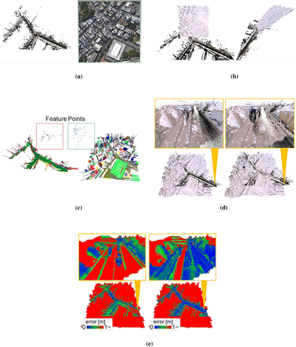
Figure 7. Experimental results of Data-set 3. (a) Aerial view of the MLS point cloud (left) and SfM mesh (right). (b) Input data from two viewpoints (pink: SfM mesh, colored points: MLS point cloud). (c) The vertical edges and extracted feature points (left: MLS point cloud, right: SfM mesh). (d) Rough registration result (left) and accurate registration result (right). (e) The distance from the vertex of the SfM mesh to its nearest point of the MLS point clouds is colored (left: rough registration, right: accurate registration).