Figures & data
Table 1. Specification of data-set.
Figure 1. Flowchart of the proposed approach for shoreline extraction.
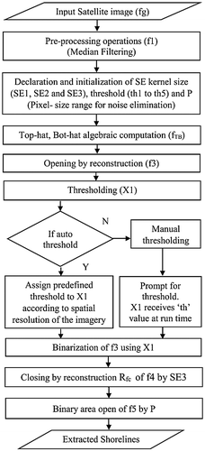
Figure 2. Illustration of results with Cartosat-1, PAN (Tile-532-338) imagery. (a) Original image, (b) Ground truth, (c) MM processed image (intermediate stage), (d) Classification outcome, (e) Proposed MM algorithm outcome.
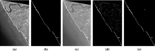
Figure 3. Illustration of results with Cartosat-2 imagery (a) Original image, (b) Ground truth, (c) MM processed image (intermediate stage), (d) Classification outcome, (e) Proposed MM algorithm outcome.
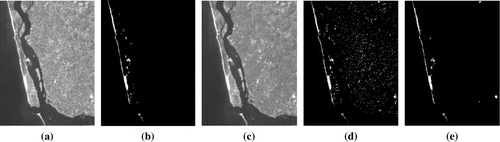
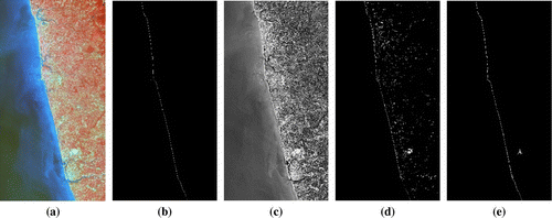
Figure 4. Illustration of results with Resource sat-2, LISS IV imagery. (a) Original image, (b) Ground truth, (c) MM processed image (intermediate stage), (d) Classification outcome, (e) Proposed MM algorithm outcome.
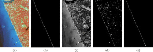
Figure 5. Illustration of results with Cartosat 1, PAN (Tile-530-334) imagery. (a) Original image, (b) Ground truth, (c) MM processed image (intermediate stage), (d) Classification outcome, (e) Proposed MM algorithm outcome.
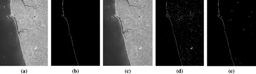
Figure 6. Illustration of results with Landsat ETM + sensor imagery. (a) Original image, (b) Ground truth, (c) MM processed image (intermediate stage), (d) Classification outcome, (e) Proposed MM algorithm outcome.