Figures & data
Figure 1. Framework of the study.
Notes: NDVI – normalized differential vegetation index; OBIA – object-based image analysis. Green blocks are input data, blue blocks are objectives, and gray blocks are outputs.
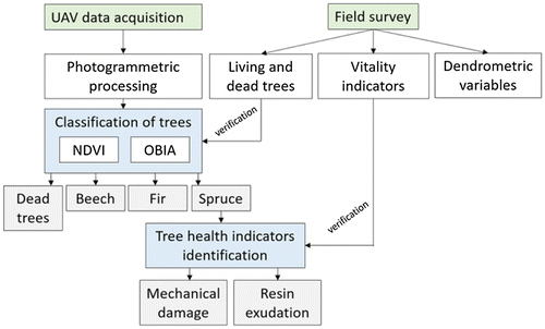
Figure 2. Location of study area and the two selected sites for field and UAV surveys.
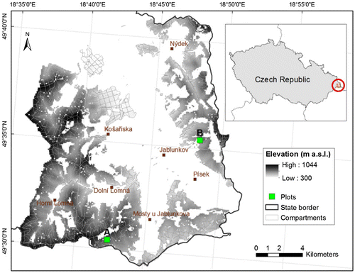
Table 1. The basic stand dendrometric characteristics including mean tree stem diameter at breast height (DBHm), mean tree height H, stand basal area (G), and stand tree density (N) for the studied plots.
Figure 3. Box-and-Whisker plots of NDVI (left) and PDC raster (right) for tree species category including alive specimen of Norway spruce, Silver fir and European beech, and standing dead trees.
Notes: The letters a, b, and c indicate significant differences between the categories (at p < 0.05) from the post hoc test of ANOVA. The length of each box shows the range within which the central 50% of the values fall, with the box edges (hinges) at the first and third quartiles. The line in the box indicates the median of the data. Outside values are plotted with asterisk. Far outside values are plotted with empty circles.
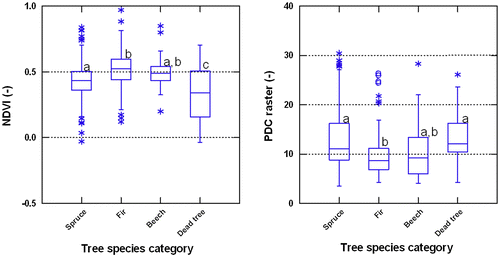
Table 2. Confusion matrixes of species classification.
Table 3. Species classification accuracy metrics.
Figure 4. Example of species classification using object-oriented image analysis: (a) RGB image; (b) segmentation; (c) classification.
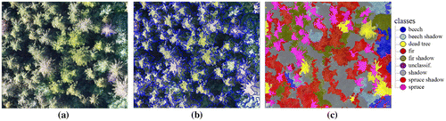
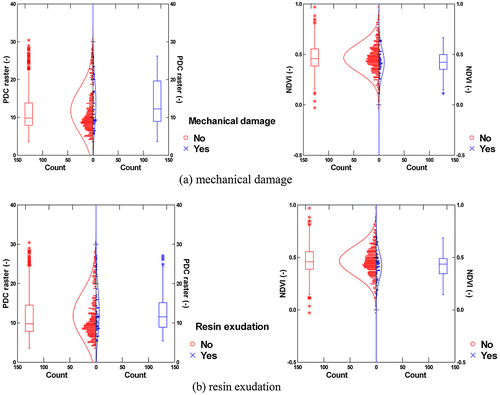
Figure 5. Testing of UAV data products (PDC raster and NDVI) against tree health indicators.