Figures & data
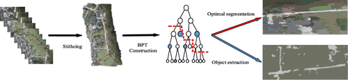
Figure 1. A brief schematic diagram for analysis of large-scale UAV images. Source: Li, Tang et al. (Citation2015).
Table
Figure 2. The hierarchical representation of a UAV image in different levels. (a) A UAV image; (b) Several levels representation of the image.
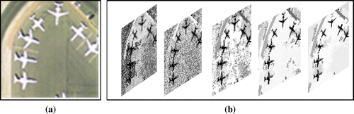
Figure 3. All valid tree slices of a particular BPT.
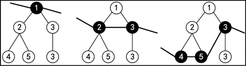
Figure 4. BPT and the corresponding path matrix. (a) BPT. (b) Path matrix.
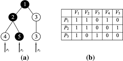
Figure 5. The same kind of node searching strategy.
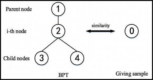
Figure 6. The large-scale UAV images of the 2013 Ya’an earthquake. Source: Li, Tang et al. (Citation2015).
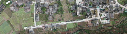
Figure 7. The experimental large-scale UAV image of Munich. Source: Koch et al. (Citation2016).
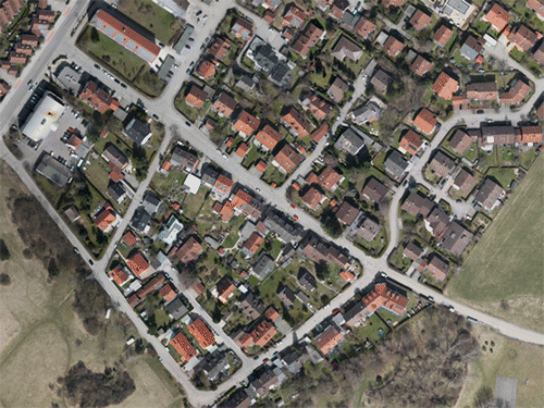
Figure 8. The optimal segmentation result of UAV image in the 2013 Ya’an earthquake. Source: Li, Tang et al. (Citation2015).
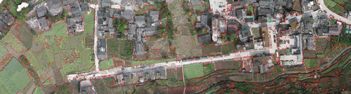
Figure 9. The intensity average of objects of UAV image in the 2013 Ya’an earthquake. Source: Li, Tang et al. (Citation2015).

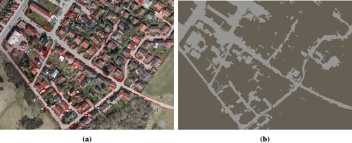
Figure 10. The optimal segmentation result of large-scale UAV image of Munich. (a) Segmentation result with red edges. (b) Segmentation result with intensity average. Source: Koch et al. (Citation2016).
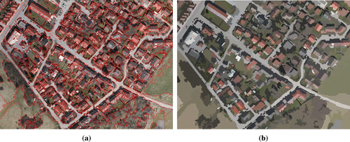
Table 1. The efficiency analysis for the two large-scale UAV images.
Figure 11. The distinguished area of grassy land and buildings in the segmentation results. (a) The distinguished area one in Munich. (Source: Li, Tang et al. Citation2015) (b) The distinguished area two in Ya’an. (Source: Koch et al. Citation2016)
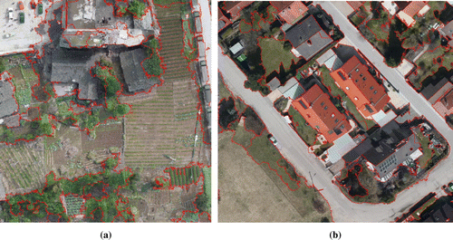
Figure 12. The road extraction result with red edges in Ya’an UAV image. Source: Li, Tang et al. (Citation2015).
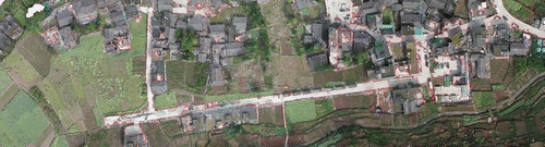
Figure 13. The road extraction result with intensity average in Ya’an UAV image. Source: Li, Tang et al. (Citation2015).
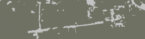
Figure 14. Road extraction results of UAV images in Munich. (a) Extraction result with red edge. (b) Extraction result with intensity average. Source: Koch et al. (Citation2016).