
Figures & data
Figure 1. The coverage map of MWC project (red gird)
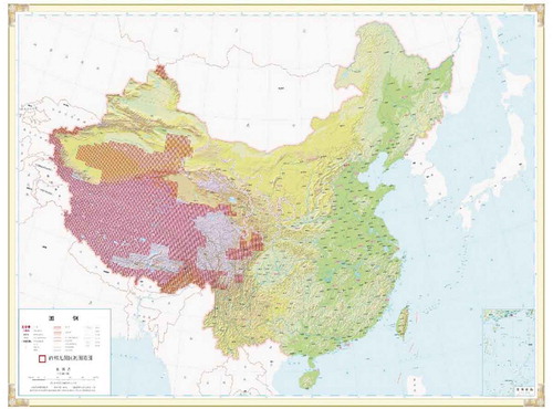
Figure 2. Mapping production
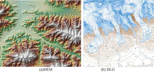
Figure 3. Interface of the intelligent interpretation workstation “FeatureStation”
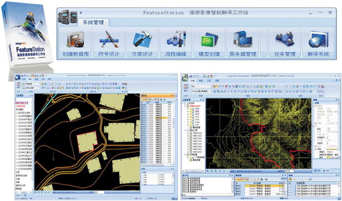
Table 1. Sensor information of ZY-3
Table 2. Sensor information of GF and GJ
Figure 4. Development of mapping ability for national dynamic mapping
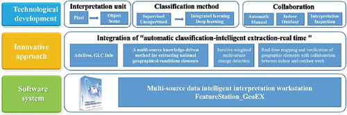
Figure 5. SAR mapping system
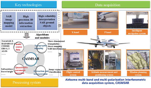
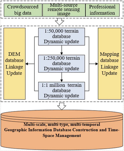
Figure 6. Workflow of database linkage update
Data Availability Statement
Data sharing is not applicable to this article as no new data were created or analyzed in this study.