
Figures & data
Figure 1. The WT01 twin satellites.
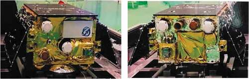
Figure 2. The navigation augmentation payload (left) and ground receiver (right) of the WT01 twin satellites.
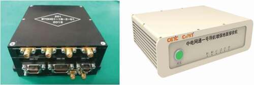
Figure 3. Schematic diagram of WT01 satellite data collection.
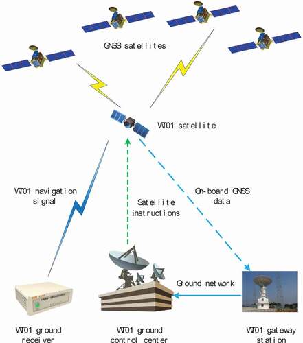
Table 1. Specific data collection period of the WT01A/B downlink navigation observation
Table 2. Dynamic POD model and strategy for WT01 mission
Figure 4. The visible GPS satellite number (top) and PDOP (bottom) of the WT01 twin satellites.
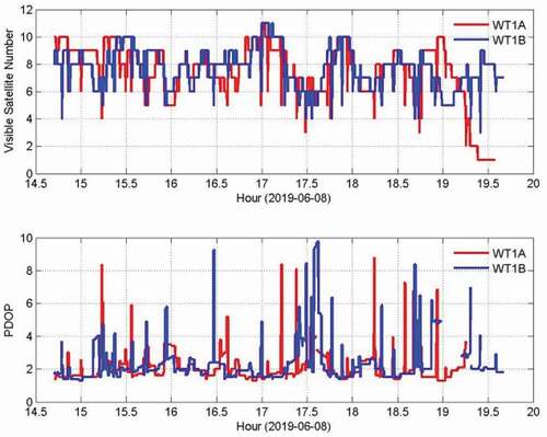
Figure 5. The visible BDS satellite number (top) and PDOP (bottom) of the WT01 twin satellites.
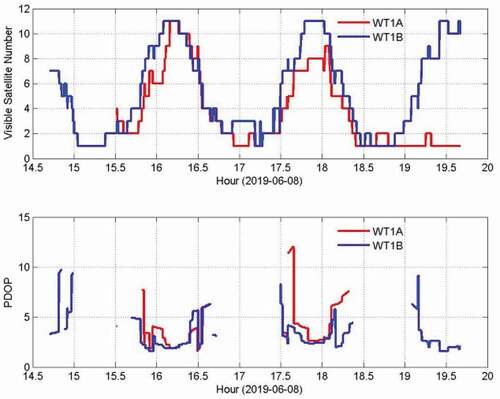
Figure 6. The statistics of the tracked satellites per epoch for BDS B1, B2 and GPS L1, L2 observation of WT01-A spaceborne GNSS receiver.
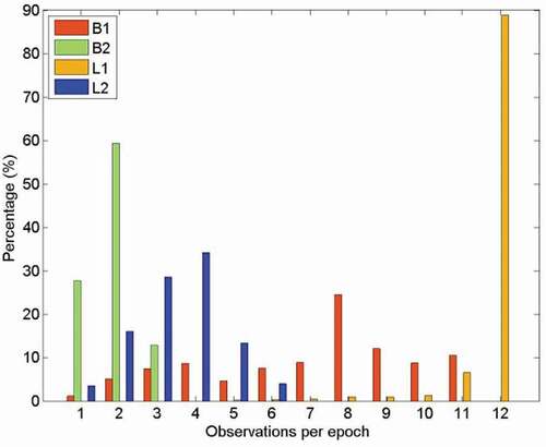
Figure 7. The statistics of the tracked satellites per epoch for BDS B1, B2 and GPS L1, L2 observation of WT01-B spaceborne GNSS receiver.
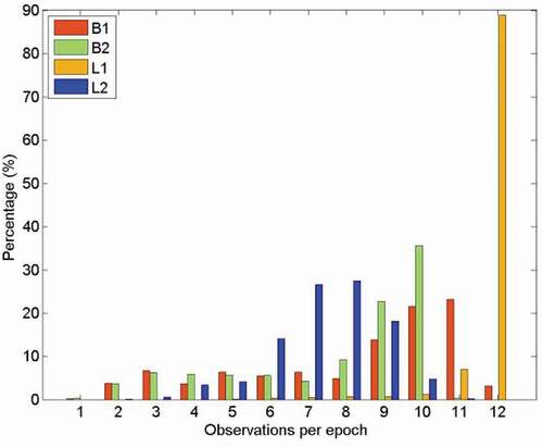
Figure 8. The multipath errors for GPS L1 (left) and L2 (right) of the WT01-A (top) and WT01-B (bottom) satellites.
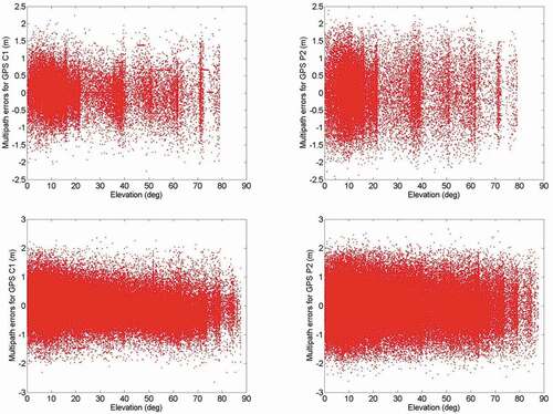
Figure 9. The multipath errors for BDS B1 (left) and B2 (right) of the WT01-A (top) and WT01-B (bottom) satellites.
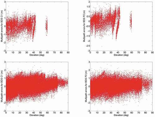
Table 3. The mean multipath errors for on-board GPS and BDS observation (unit: m)
Figure 10. Orbit overlap zone diagram.
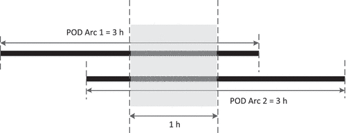
Figure 11. Error bar of the orbit overlapping precision in R, T, N, and 3D direction of the WT01-B satellite.
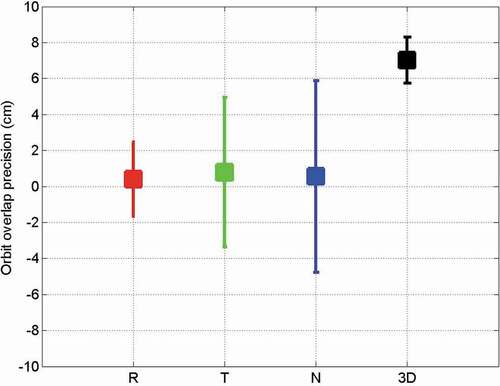
Figure 12. Code and phase residuals of WT01-B satellite short-arc POD.
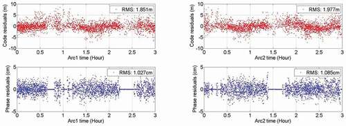
Figure 13. The multipath errors for Z1 (left) and Z2 (right) navigation signals of WT01-A (top) and WT01-B (bottom) satellites.
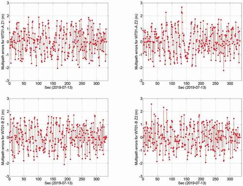
Figure 14. The average multipath errors of Z1, Z2, L1, L2, B1, and B2 frequencies.
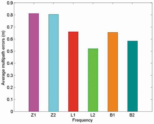
Table 4. The multipath errors for WT01-A/B, GPS, and BDS downlink navigation observation (unit: m)
Figure 15. The C/N0 of WT01-A (left) and WT01-B (right) navigation signals on 13 July 2019.
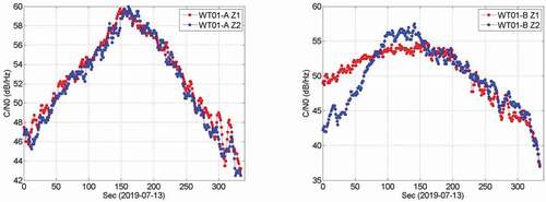
Figure 16. The C/N0 of GPS L1 (green), L2 (black) and BDS B1 (cyan), B2 (magenta) navigation signals on 13 July 2019.
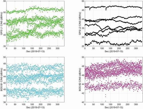
Table 5. The C/N0 range of WT01-A/B, GPS, and BDS downlink navigation observation (unit: dB/Hz)
Data availability statement
The data that support the findings of this study are available from the corresponding author, upon reasonable request.