
Figures & data
Figure 1. The core of the National land administration model.
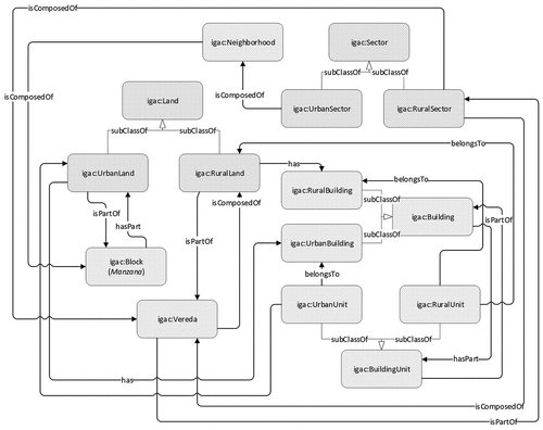
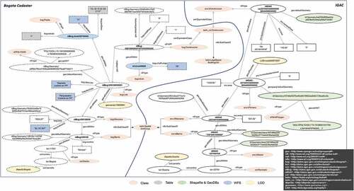
Figure 2. The core of the Bogota land administration model.
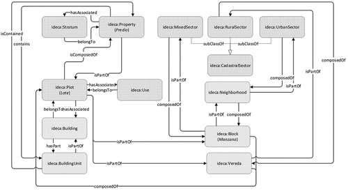
Figure 3. The core of the LADM and multipurpose cadastre models.
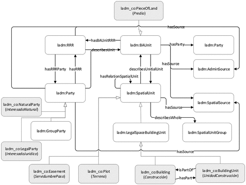
Table 1. An example of an axiom definition
Table 2. Some examples of object and data properties added
Figure 4. An overview of our integrated proposal for the Colombian land administration.
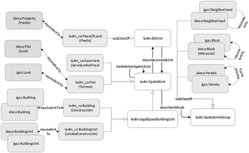
Figure 5. The land administration data cycle.
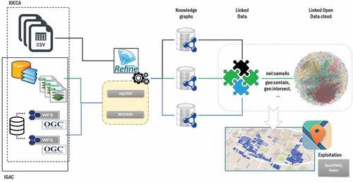
Figure 6. An excerpt of land administration knowledge graphs.
Listing 1. Land property RDF data from tables
Listing 2. An excerpt of RDF data from shapefiles
Listing 3. An excerpt of RDF data from WFS
Listing 4. Spatial relations between RDF data
Listing 5. RDF data interlinked to DBpedia
Listing 6. RDF data interlinked to GeoNames and LinkedGeoData
Figure 7. An example of a query for integrating data from Bogota Cadastre & IGAC and its visualization of gathered results.
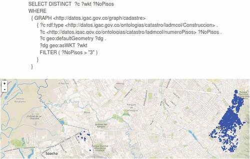
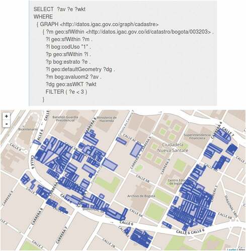
Figure 8. An example of query integrating data from the Bogota Cadastre.
Data availability statement
The knowledge graphs associated with this contribution are available on http://20.115.164.119:8089/parliament/.