
Figures & data
Figure 1. The phases of the proposed RFSG model.
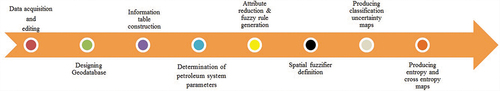
Figure 2. The study area.
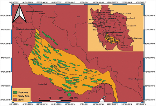
Figure 3. Chronostratigraphic chart of Fars province.
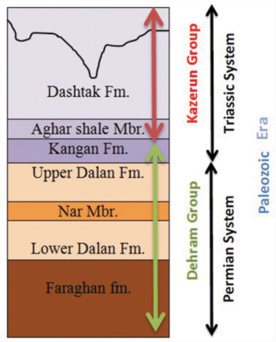
Table 1. Classification for the quantity of the condition attributes.
Figure 4. Location of structures in .
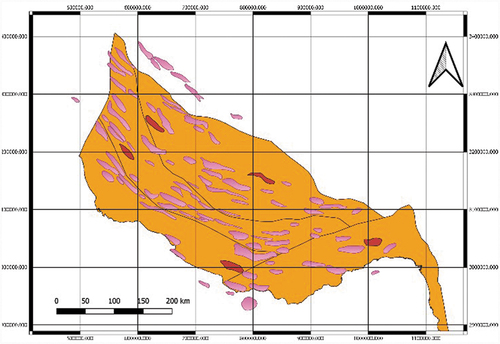
Table 2. The first five rows in the weighted and ranked information table for the hydrocarbon system parameters.
Figure 5. Spatial autocorrelation report and its results.
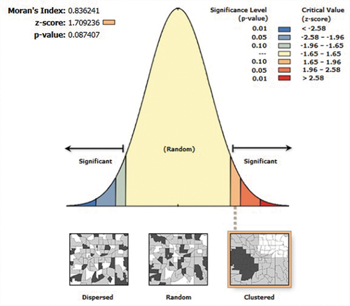
Figure 6. Thiessen polygons for calculating the fuzzy membership function.
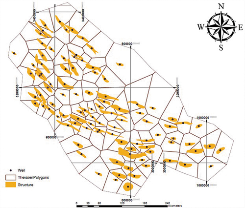
Table 3. List of the qualified rules.
Figure 7. (a) Fuzzy entropy of the results. (b) Fuzzy cross-entropy of the results.
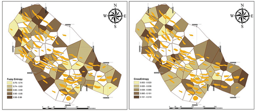
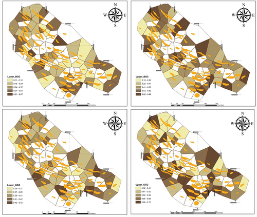
Figure 8. Structures granulation of the hydrocarbon structures, according to lower and upper approximation of BGC and GGC.
Data availability statement
The data that support the findings of this study are available from the corresponding author, upon reasonable request (https://www.researchgate.net/profile/Sahand-Seraj-2).