
Figures & data
Table 1. Basic parameters of several laser altimeter satellites used for stereo mapping.
Figure 1. Framework of the geometric positioning model integrating OSSI and spaceborne laser altimeter data.
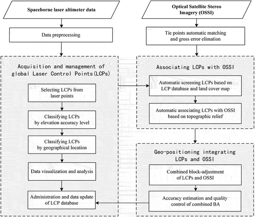
Figure 2. Acquisition and management of the global laser control points (LCPs).
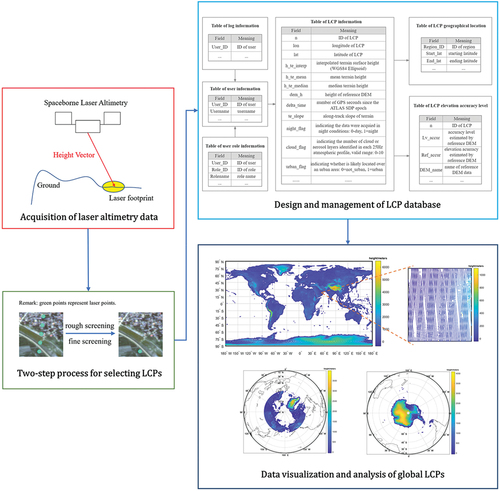
Table 2. Classification rules of LCPs by elevation accuracy.
Table 3. Evaluation accuracy of laser control points with different elevation accuracy levels.
Figure 3. Automatic LCPs screening based on the LCP database and land cover (the left is before the process, and the right is after the process).
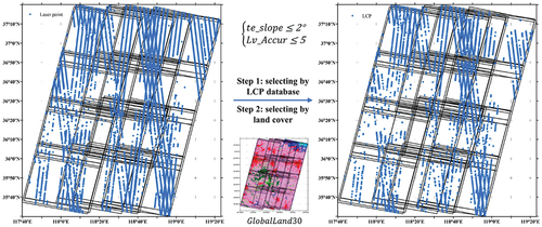
Figure 4. Automatic association of LCPs and OSSI based on topographic relief.
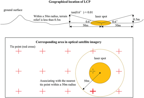
Figure 5. Experimental area and data (the left is the land cover map, and the right is ZY-3 optical stereo imagery).
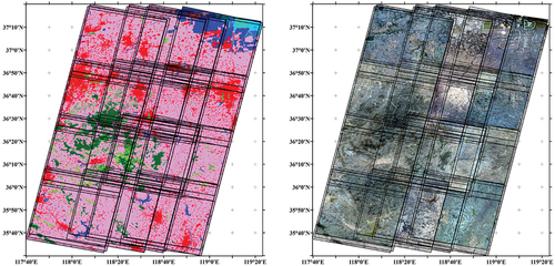
Figure 6. Distribution of tie points (left) and ECPs generated from the association of LCPs and OSSI (right).
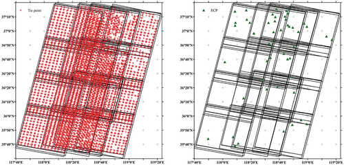
Table 4. Plane accuracy of the tie points (px).
Table 5. Elevation accuracy of the combined BA (m).
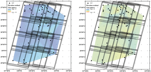
Figure 7. Elevation accuracy before and after the combined BA (the left is before BA, and the right is after the combined BA).
Data availability statement
The ZY-3 stereo imagery data that support the findings of this study are restricted in access and use, but can be queried and requested from the website of the China Centre for Resources Satellite Data and Application (CRESDA) (http://www.cresda.com/EN/) and Chinese Natural Resources Satellite Remote Sensing Cloud Service Platform (http://sasclouds.com/chinese/normal/). The ICESat-2 data are openly available and can be acquired from the National Snow & Ice Data Center (NSIDC) at https://nsidc.org/data/. The GlobalLand30 data can be downloaded at https://www.globallandcover.com/.