
Figures & data
Table 1. Classification of trajectory characteristics.
Figure 1. Summary of trajectory feature structures.
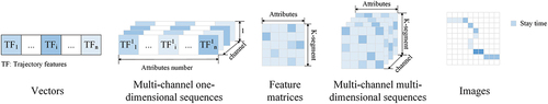
Figure 2. Schematic of GPS data point sequence.
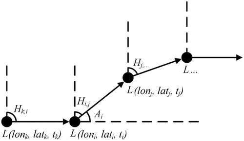
Figure 3. The network structure of MSAF.
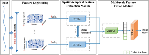
Figure 4. The process of time window selection, multi-scale definition, and attribute calculation in feature engineering.
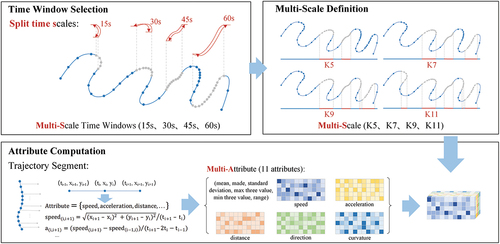
Figure 5. Spatio-temporal feature extraction module used in MSAF.
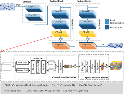
Figure 6. Multi-scale feature fusion module used in MSAF.
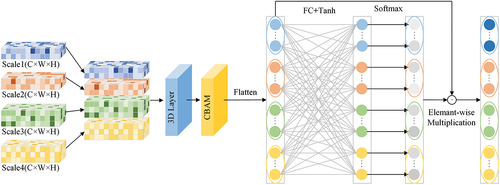
Table 2. Model structure.
Table 3. Comparison of TMI accuracy with classical model for different time intervals.
Table 4. Confusion matrix for MSAF and baseline CNN-attention model.
Figure 7. Recall and precision of MSAF and baseline CNN-attention model.
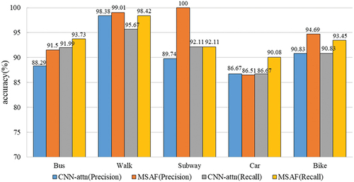
Table 5. Comparison of accuracy with related studies.
Table 6. The schematic setup for verifying the effectiveness of multi-scale feature combinations.
Figure 8. Performance comparison of different scale combinations.
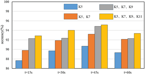
Table 7. Ablation experiments with MSAF.
Data availability statement
The GeoLife dataset can be found at https://www.microsoft.com/en-us/research/publication/geolife-gps-trajectory-dataset-user-guide/. The Sussex-Huawei Locomotion dataset can be downloaded from http://www.shl-dataset.org/.