Figures & data
Figure 1. The seven-county Twin Cities metropolitan area, Minnesota, USA.
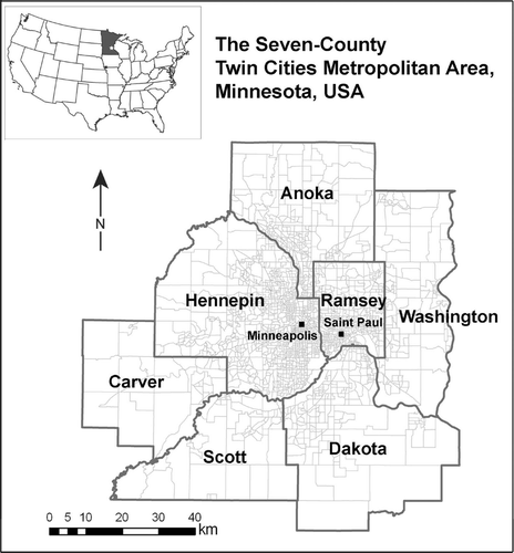
Figure 2. Accuracy of the TM-estimated per cent imperviousness images.
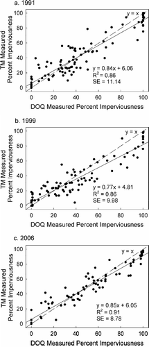
Figure 3. Per cent impervious surface maps of 1991 (a, b) and 1999 (c, d) for both methods (Method A – adjusted impervious surface map with highway centerline and areas greater than 75% imperviousness masked out; Method B – pure residential impervious surface map with all non-residential areas masked out).
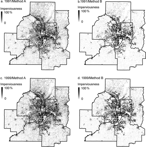
Figure 4. Two-, five- and seven-county population density estimation models of Method A.
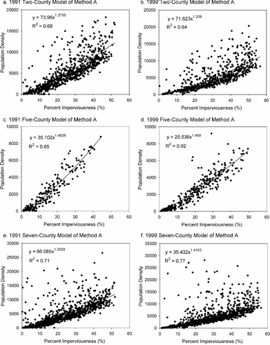
Figure 5. Two-, five- and seven-county population density estimation models of Method B.
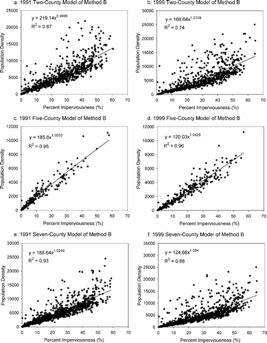
Figure 6. Overall performance of two-, five- and seven-county population density estimation models of Method A.
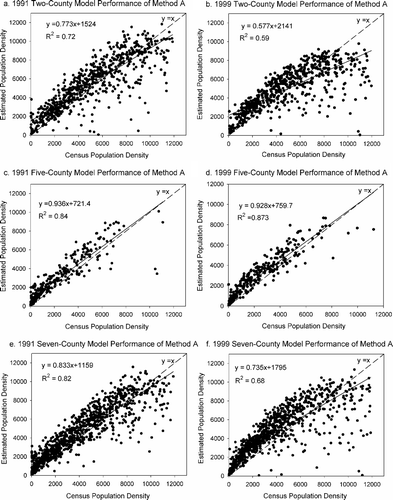
Figure 7. Overall performance of two-, five- and seven-county population density estimation models of Method B.
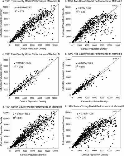
Table 1. Performance statistics of population density estimation models.
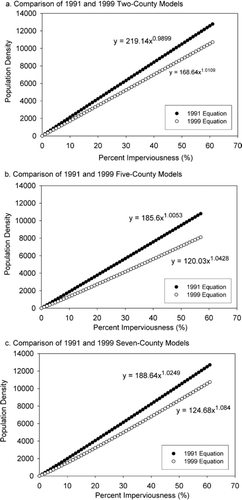
Figure 8. Comparison of 1991 and 1999 population density models of Method B.