Figures & data
Figure 1. A Mongol ger (a) and a typical example of a ger district in Ulaanbaatar represented in a Quickbird image of 2002 (b) (1-ger and 2-house).
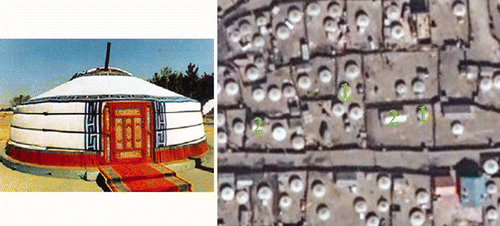
Figure 2. 2001 ETM image of Ulaanbaatar area (red, band 5; green, band 4; blue, panchromatic band). The size of the displayed area is about 28 km × 20 km.
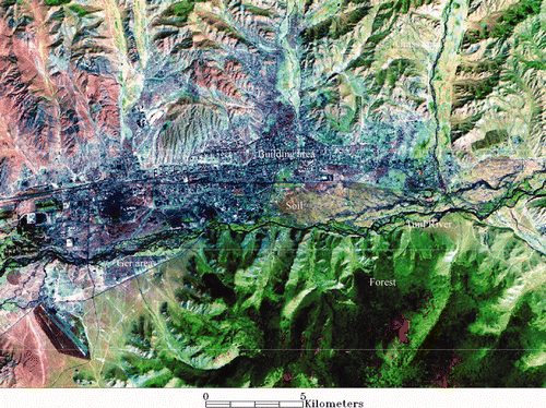
Figure 3. Comparison of the multi-temporal PC images. (a) PC image of 1990 data sets (red, PC1; green, PC2, blue, PC3), (b) PC image of 2001 data sets (red, PC1; green, PC2; blue, PC3).
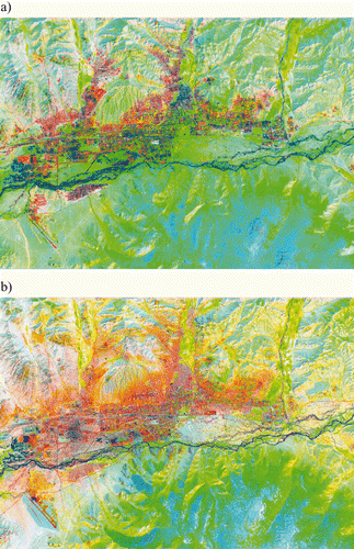
Table 1. Principal component coefficients.
Figure 4. Comparison of the classification results for the selected classes. (a) Classified image using 1990 data sets, (b) classified image using 2001 data sets.
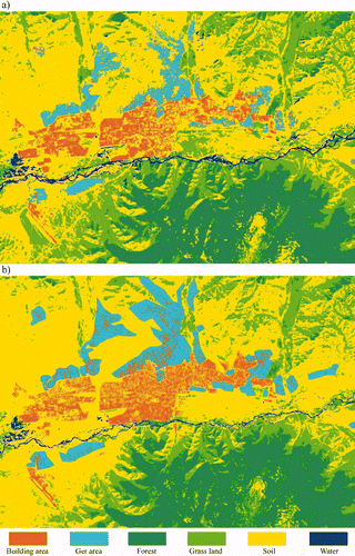
Figure 5. A general diagram for the refined parametric classification.
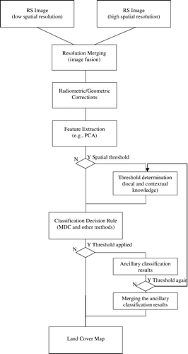
Table 2. Confusion matrix produced for the classified PC images.
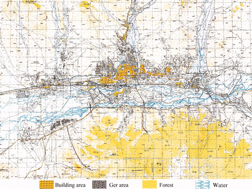
Figure 6. Topographic map of Ulaanbaatar area of 1969, scale 1:50,000. The size of the displayed area is about 28 km × 20 km.