Figures & data
Figure 1. The study area, MoF, presented by its drainage map.
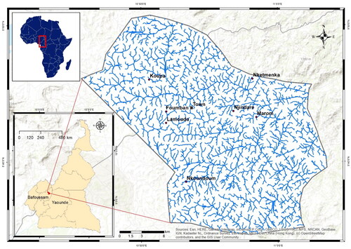
Figure 2. The geomorphological map of MoF.
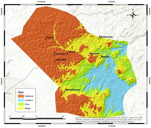
Figure 3. The geological map of MoF.
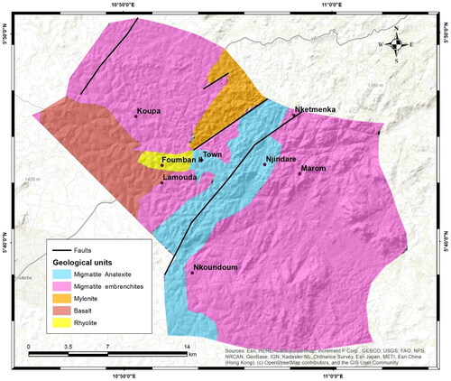
Figure 4. Flowchart for GWP investigation.
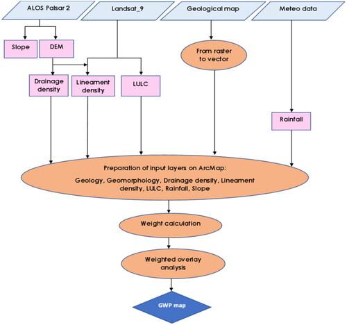
Table 1. Constant rating scale of Saaty’s AHP.
Table 2. The RI ratio of the distinct values of n.
Table 3. Normalised weights of different factors for pairwise comparison.
Table 4. The six parameters used for GWP assessment ranked in descending order.
Figure 5. Distribution and extension of the slope classes of the study area.
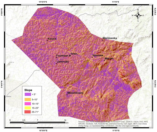
Figure 6. Distribution and extension of the drainage classes of the study area.
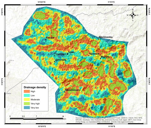
Figure 7. Distribution and extension of the LULC classes of the study area.
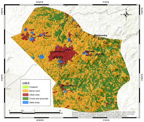
Figure 8. Distribution and extension of the lineament density classes of the study area.
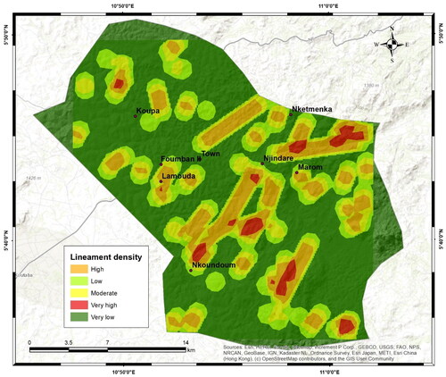
Figure 9. Distribution and extension of the topographic wetness index of the study area.
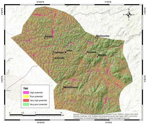
Figure 10. Distribution and extension of the rainfall classes of the study area.
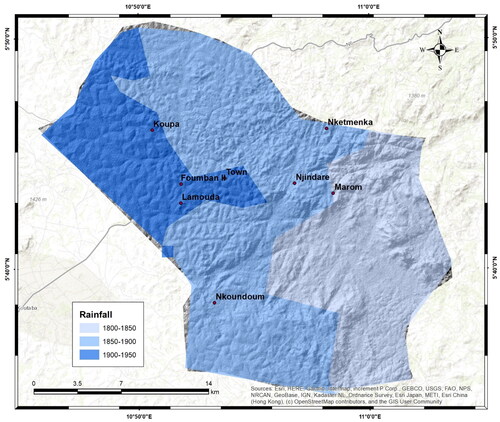
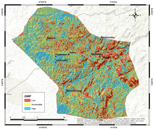
Figure 11. Thematic map of the groundwater potential zones distribution in MoF.